San Diego Hikes: Our Regular 4-mile Torrey Pines hike 4 mile
San Diego is made for hiking and repeat visitors are always asking for new scenic hikes. However, the one hike that is always first on the list for its spectacular views is Torrey Pines State Reserve. This park has many trails and we have several hikes we do which range from 2 to 8 miles. In this post we thought we would share our most popular hike for newcomers, our basic 4 mile loop Torrey Pines hike. With stops to enjoy the views this is a wonderful 2 hour trip that while not overly strenuous provides a nice workout.
UPDATE: NOVEMBER 2020: This hike remains a classic. However, this is an early article we are in the process of updating. Check out our full Torrey Pines guide for more info and recent hikes.
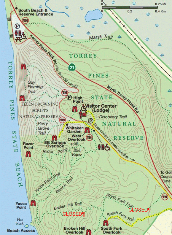
- Starting Point: South Beach Lot, Torrey Pines State Beach
- Length: 4 miles Elevation: 300 ft gain and loss
- Type: Loop
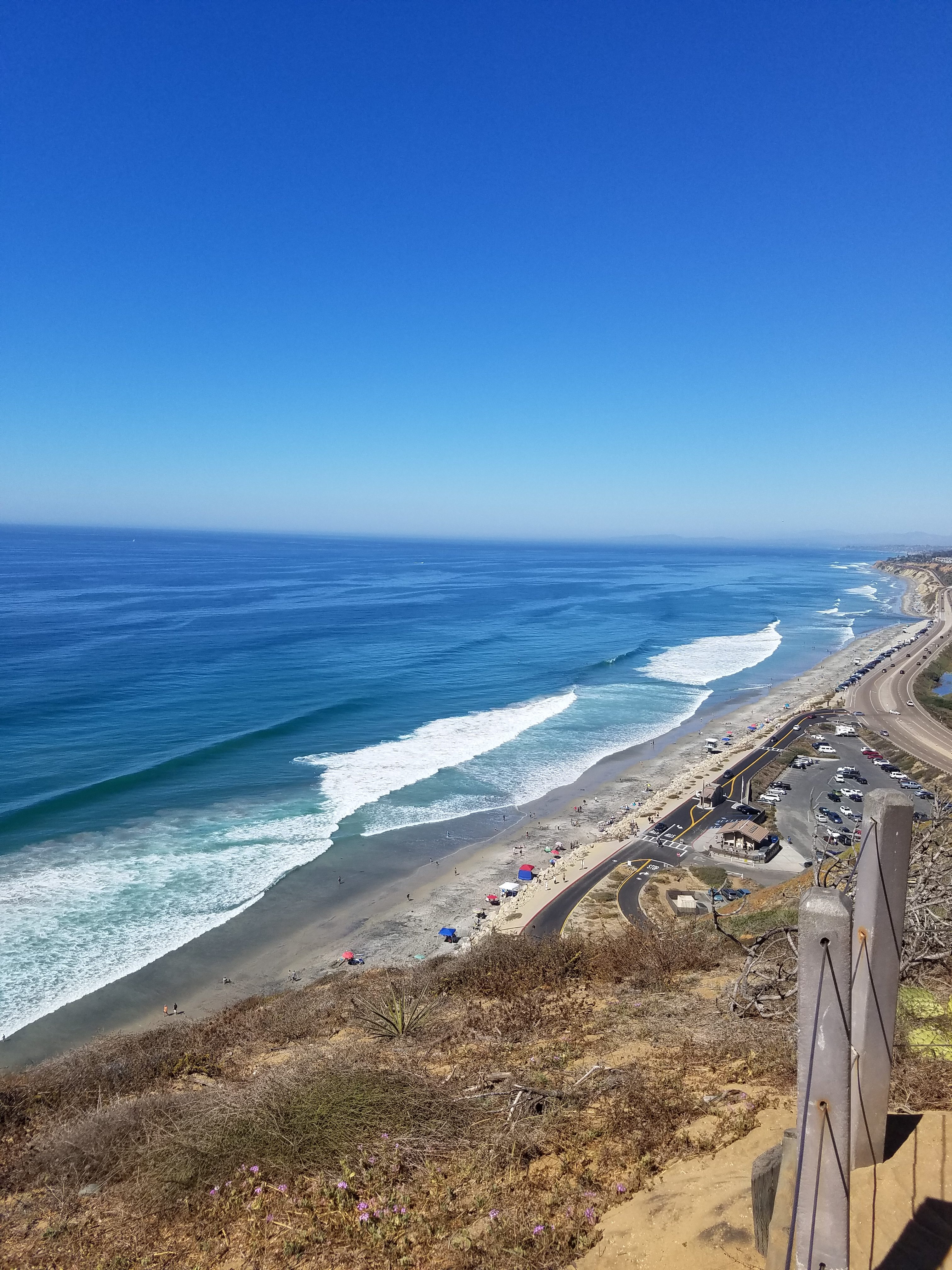
Given the San Diego weather this hike can be done anytime of year. Being on the coast it doesn’t get too hot during the summer and winters tend to be warm and sunny. Of course, after a rain the trails are likely to be closed. The one caveat is you don’t want the tide to be too high. Check a tide chart such as this one and make sure the tide is less than 4 feet. The lower the better because at low tide you can walk out on the rocks at the beach. There is the danger of getting stuck in a rare high tide like these people in the summer of 2017, but generally it means you simply will need to retrace your steps instead of walking back along the beach.
Our house is 15 minutes from the Torrey Pines South Beach entrance parking lot on Torrey Pines road/Pacific Coast Highway. Because we go so often we invest in an annual California State park pass. This pass costs $195 a year and allows access to almost all state parks. Regular parking at Torrey Pines ranges from $10-20 (higher on weekends and summer) so this pass is only worth it if you are going to be visiting the parks 15 or more times a year. For us it is a no brainer because we go to Torrey Pines several times a month and also Cardiff State Beach during the summer. If you don’t want to pay to park there is some free parking on the PCH road just north of the entrance. That parking fills up fast and if you don’t mind an extra walk free parking is usually available on Carmel Valley Road right by the entrance to Torrey Pines State Beach.
If you park there it is about an extra mile walk along the beach to the “official” start of our walk. From the parking lot you will see some steps and a sign leading up to the visitor center. These steps go up to a paved road which you will follow up the hill. If you paid for parking we should note that you can drive to the top and park. That saves the initial uphill climb but if you do our loop you will still have to walk up at the end. The walk up the hill is generally where reluctant kids lose it and the 2 mile option avoids the climb. Overall it is about a 300 foot elevation gain.
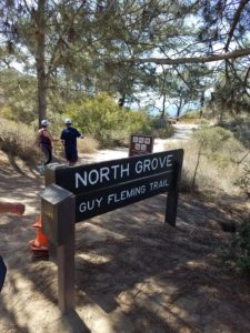
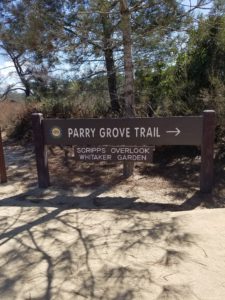
Follow the road until you come to the sign saying Guy Fleming trail. From here you have two options: 1) you can go on the 2/3 mile Guy Fleming loop or walk further up the hill to the Parry Grove trail. The Parry Grove trail is only 1/2 mile but there are 118 steep steps so it is harder. For our 4 mile hike we usually pick one but of course you can do both. Overall Guy Fleming is easier and has better views so for first timers we suggest that one. There are two stops on Guy Fleming that have great views overlooking the ocean.
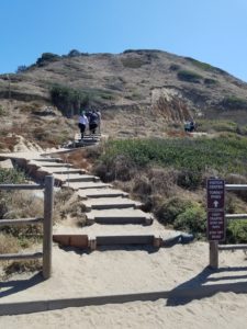
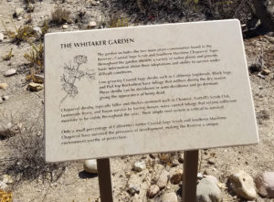
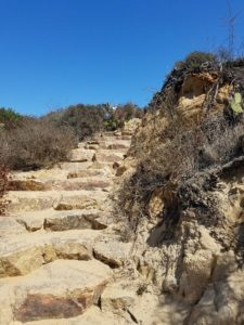
The Guy Fleming loop takes you right back to the road where you continue uphill. Your next stop is the Parry Grove/Whitaker Gardens loop. Whitaker Gardens is a short loop around some well-identified native plants. Halfway through the loop you will find the entrance to the Parry Grove loop trail which goes down 118 steps and follows a half-mile loop where you climb back out and go back to the main road. We usually pick either Guy Fleming or Parry Grove but of course you can easily do both.
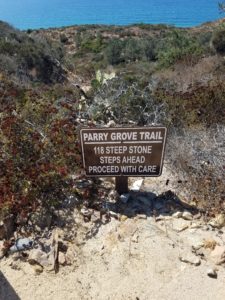
Walking down the Parry Grove steps can be an easy ankle twister. Follow the sign and proceed with care!
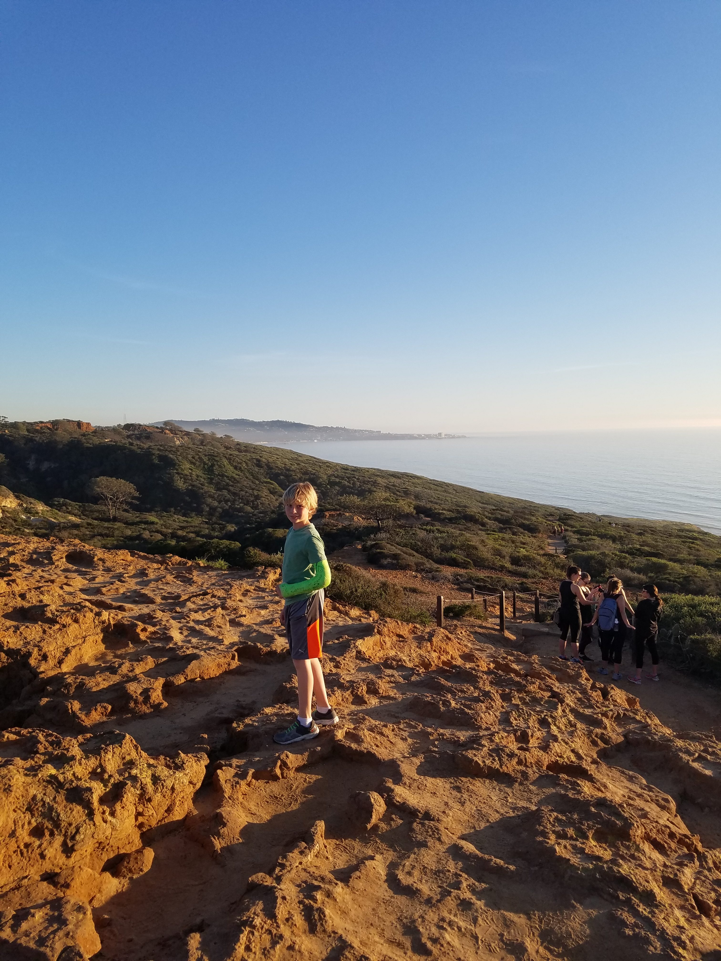
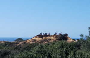
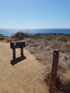
From Parry Grove it is a short walk to the top of the hill where you find the visitor center, the top of the hill parking lot, restrooms and the start of the Beach Trail. The visitor center is a nice rest/refueling stop for next part of the adventure. From the visitor center cross the street and head through the parking lot to find the sign pointing toward Beach Trail, Razor Point, Red Butte and Yucca Point. For our walk we follow the Beach Trail which generally veers downhill to the left. A popular stop off point right off the trail to the right is Red Butte, a large rock formation with spectacular views. Razor Point and Yucca Point are optional out and back add-ons that take you to views overlooking the ocean. Doing both adds about a mile to the hike. Kids will probably insist on stopping at Red Butte but it can get crowded. 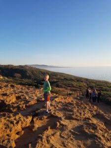
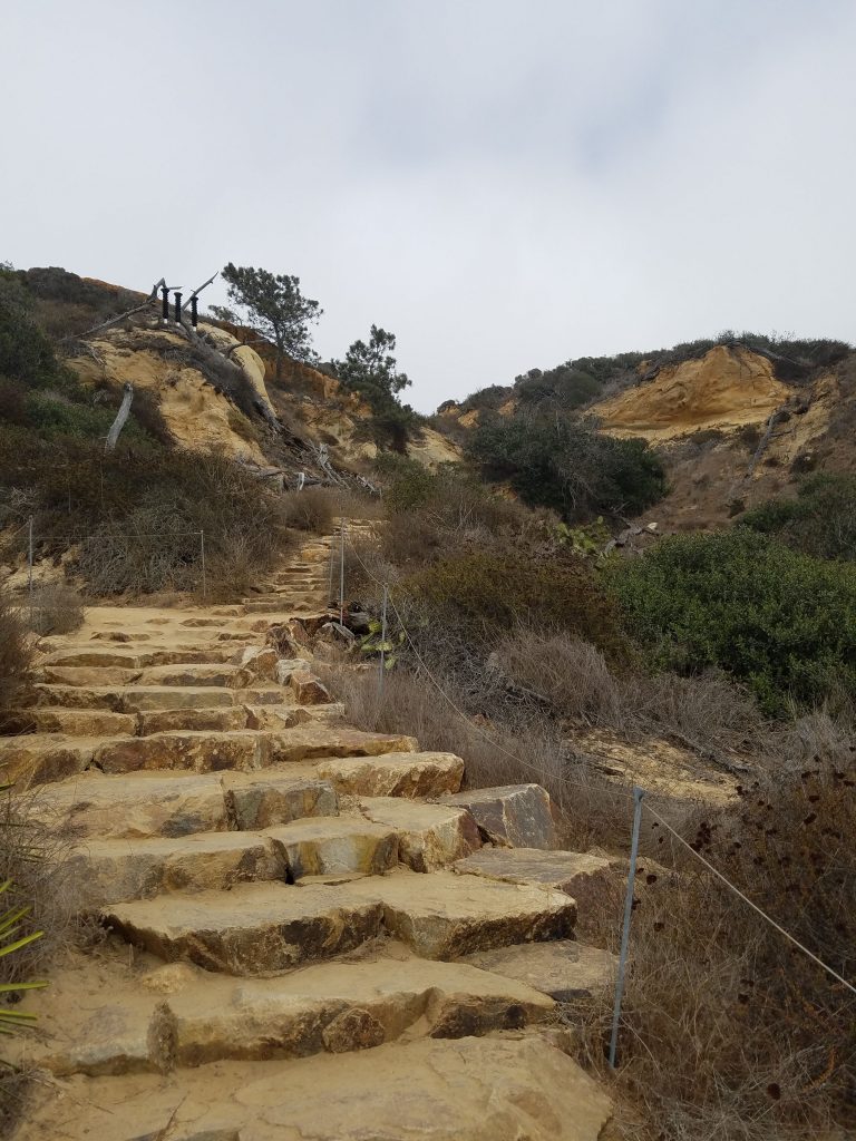
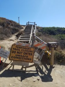
Past Red Butte, the Beach Trail follows a moderately steep downhill path to the beach. The very last part is a staircase down to the beach. Our favorite six-mile hike goes up Broken Hill Trail to North or South Fork Trail but that route has been closed for sometime now.
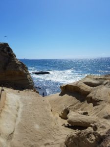
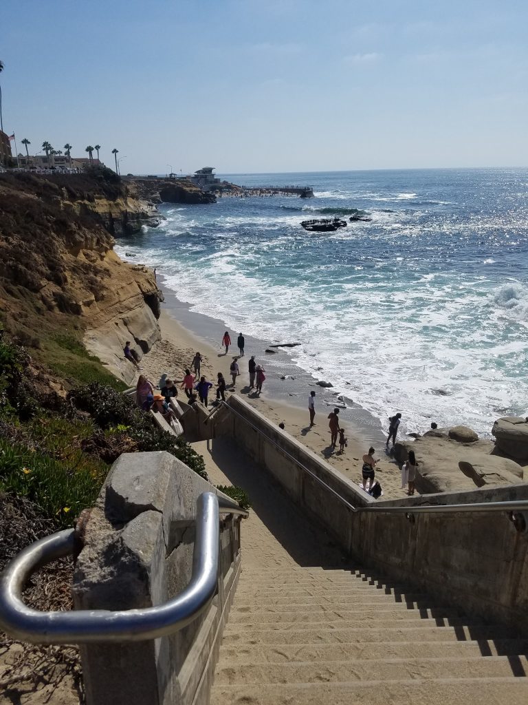
Once you hit the beach to your left you will see a large rock that juts out into the ocean. During low tide you can often climb on that rock. Even during high-tide you can go around the bluff on a narrow trail. Just realize that once you go around the rock about a mile south is Black’s Beach, a famous nude beach. A Cub Scout pack made that mistake and ended up on national news. We generally play around on the rocks for awhile and then start our journey back along the beach. The other option is to head up the hill and back track but of course that adds another 300 foot climb and is more strenuous. If you go during high tide you may have no choice but to head up the trail, but in most cases you have plenty of beach to walk on. It takes about 15 minutes of walking on the beach and you are back at the parking lot. A nice moderate workout that has enough cool stuff that kids usually don\t complain about too much.
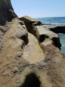
The rock at the bottom of the stairs is a must climb. When the tide is low you can spend time climbing out on the rocks. Overall as long as the tide is below 4 feet this hike is fine, but at low tide you can have more exploration.
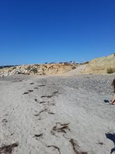
The end is the short road to the parking lot about a 15 minute walk down the beach.
Where to Stay
Via car, Torrey Pines is convenient to almost any location in San Diego. Torrey Pines is right off the I-5 freeway at the Carmel Valley Road exit. The park is located near the UTC-area of La Jolla by the University of California-San Diego. There are three resorts within walking distance of Torrey Pines that sit on the bluff overlooking Black’s Beach by the golf course. The Lodge at Torrey Pines is right on the golf course
- Check Prices for the Lodge at Torrey Pines on Booking.com
- Check Prices for the Lodge at Torrey Pines on HotelsCombined
Hilton La Jolla Torrey Pines, a resort style hotel next to the golf course
- Check Prices for Hilton La Jolla Torrey Pines, on Booking.com
- Check Prices for Hilton La Jolla Torrey Pines on HotelsCombined
Estancia La Jolla Hotel and Spa is across from UCSD and next to the Salk Institute. This is a longer walk, about a mile from Torrey Pines but near the Gliderport.