San Diego 59-Mile Scenic Drive Part One
San Diego’s 59-Mile Scenic Drive is something we have always been familiar with. As you drive through the city, you can not miss the familiar seagull signs. However, until recently we had never formally taken the full tour. This is our pictorial guide to the 59-Mile Scenic Drive.
Jump Ahead To
Overview
The 59-Mile Scenic Drive is entirely within the city of San Diego. It goes by almost every major attraction and most of the city’s coast. Over the years we have done every portion of the drive on a frequent basis. However, we had never taken the time to do the full drive.
The COVID-19 stay-at-home alert inspired this full trip along the 59-Mile Scenic Drive. Not only were major San Diego attractions closed, but beaches and parks were also closed. The drive was a perfect alternative.
It turns out the 59-Mile Scenic Drive is a great way to get an overview of San Diego. There are many places to stop and enjoy the scenery. A complete drive, including stops, is likely to take a full day. This is on the list of top free San Diego attractions.
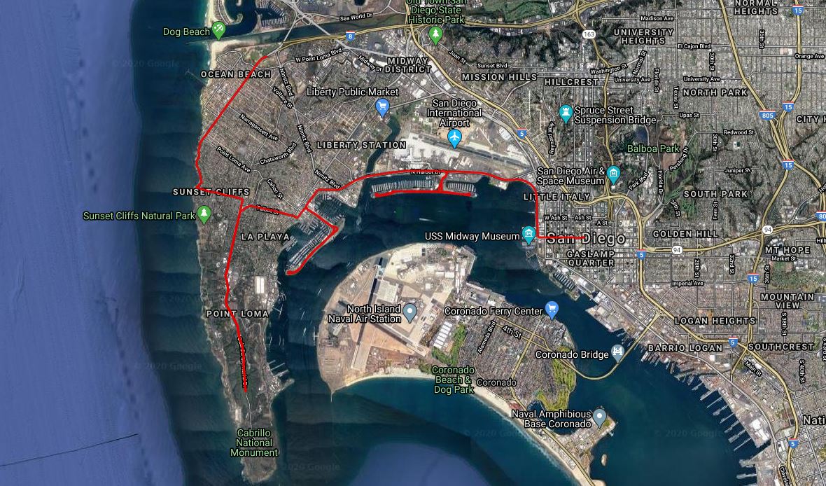
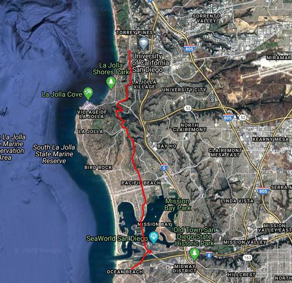
We split the drive into two roughly 30-mile portions. The first portion starts in downtown and loops past the airport and through Point Loma. From there it goes through Mission Bay, up Mount Soledad and ends at UCSD.
The second portion starts at UCSD and heads through La Jolla, Pacific Beach, and Mission Beach before turning inland towards Old Town and some of San Diego’s oldest neighborhoods. It goes through the heart of Balboa Park before ending back in downtown San Diego.
Almost all the pictures were taken from the car by our kids. However, we have also included links to more detailed overviews of the attractions along the drive.
The blue and white seagull signs make the drive easy to follow. Of course, there are many places to stop along the way. Our recommendation would be to combine the drive with some stops to walk around, have lunch and enjoy the scenery.
This is part one.
Downtown/Airport
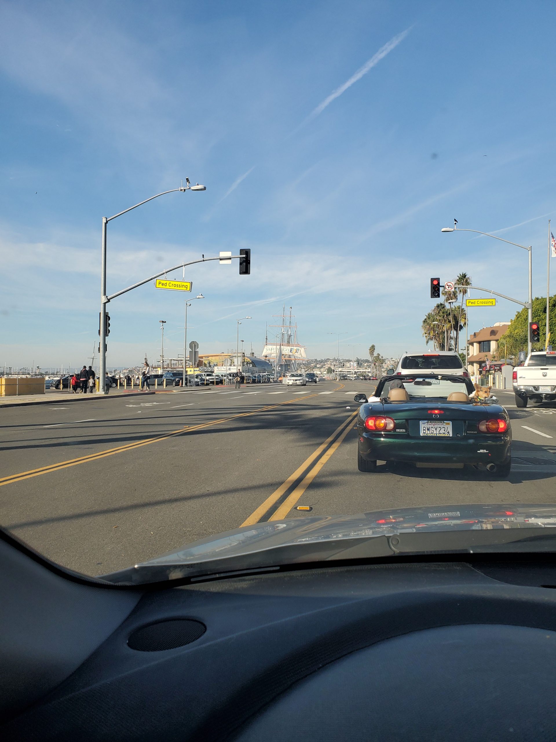
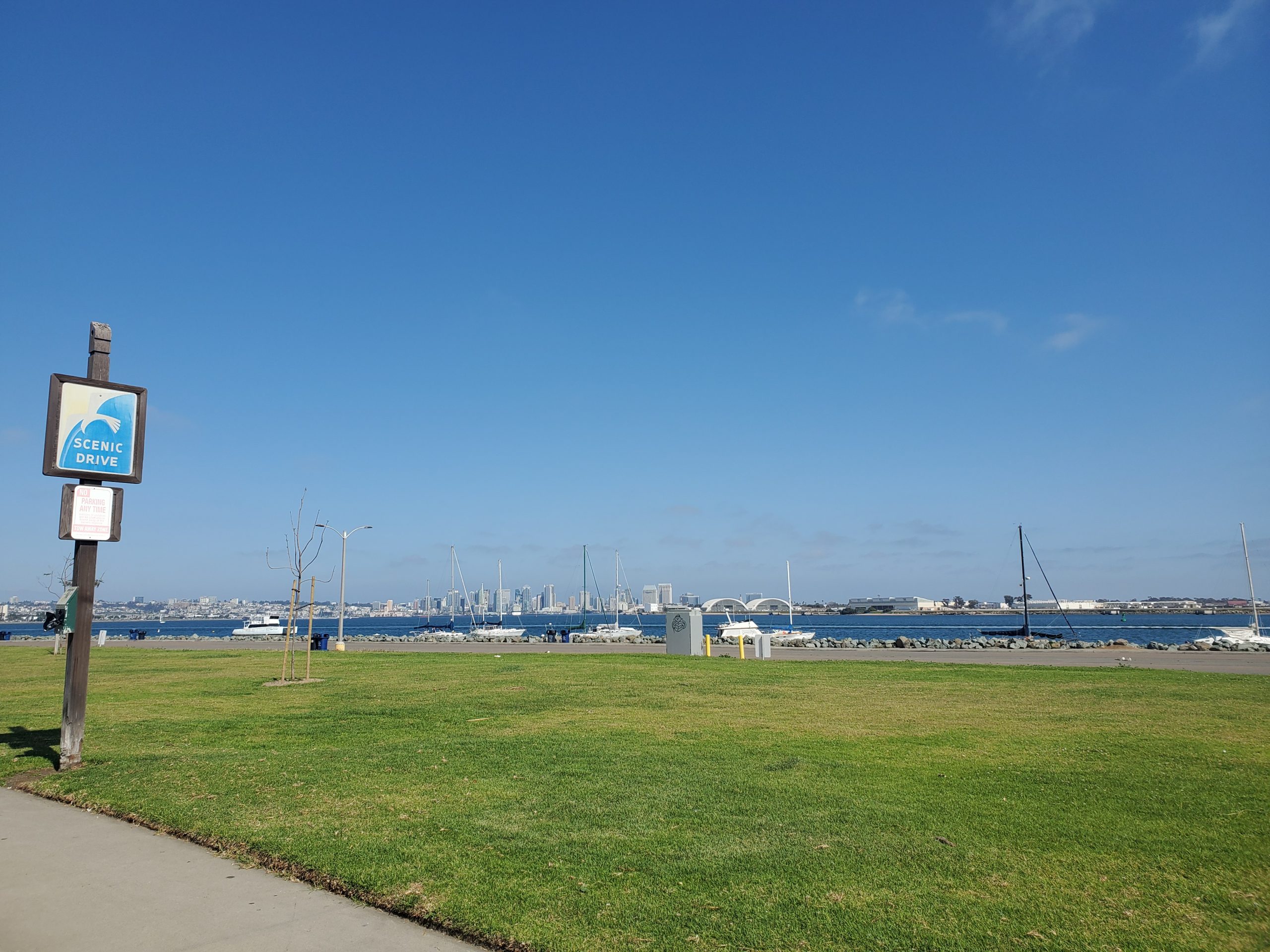
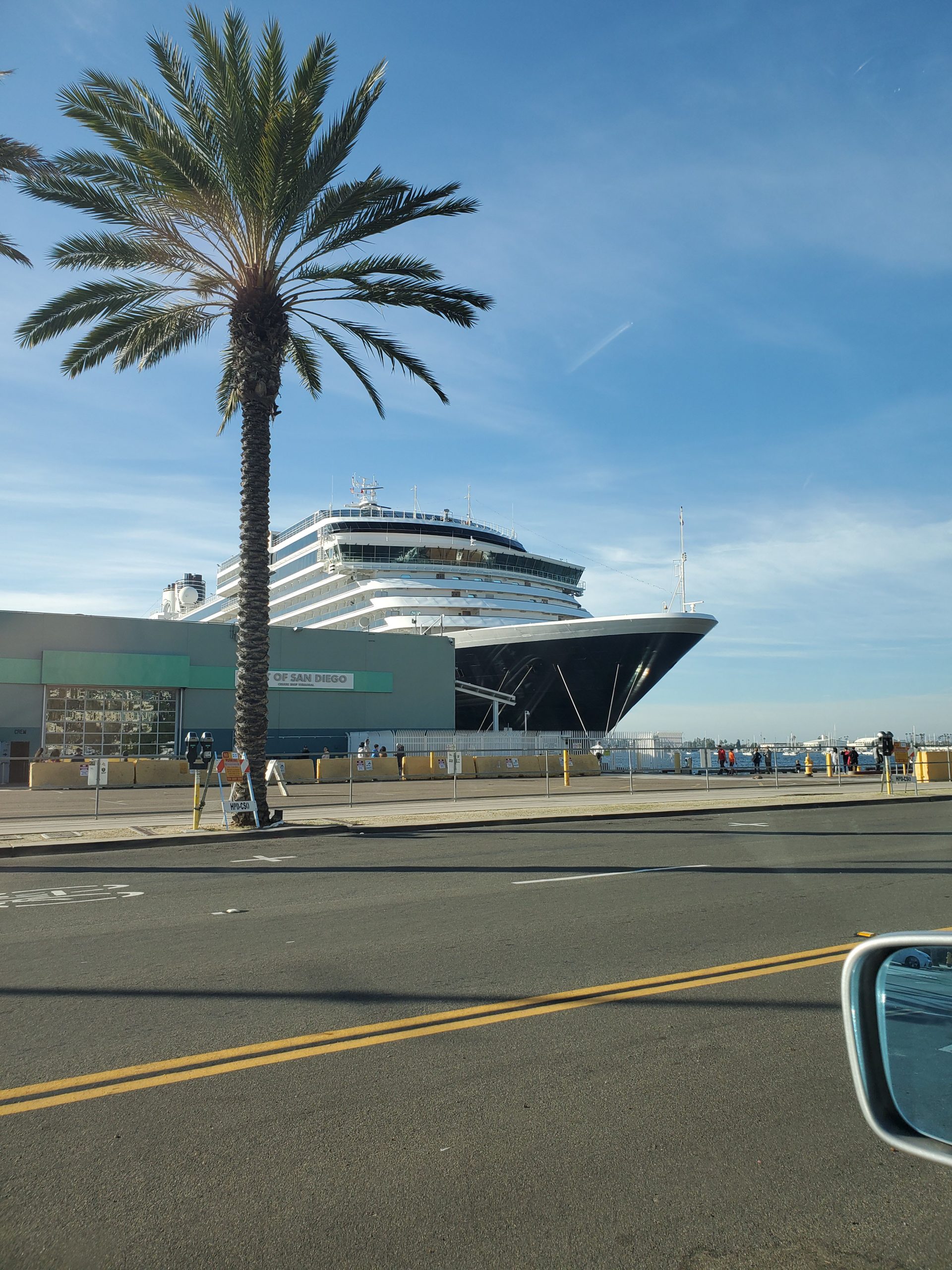
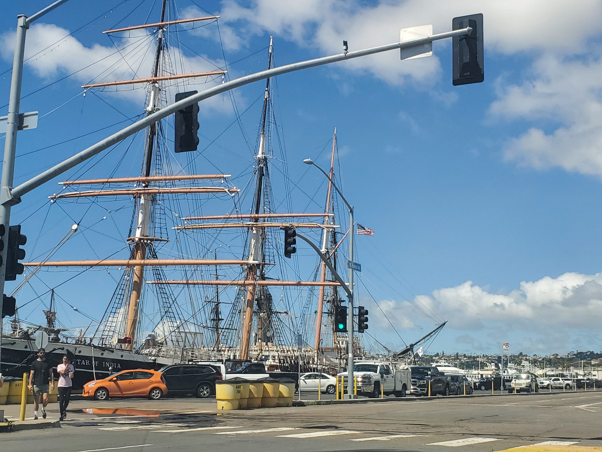
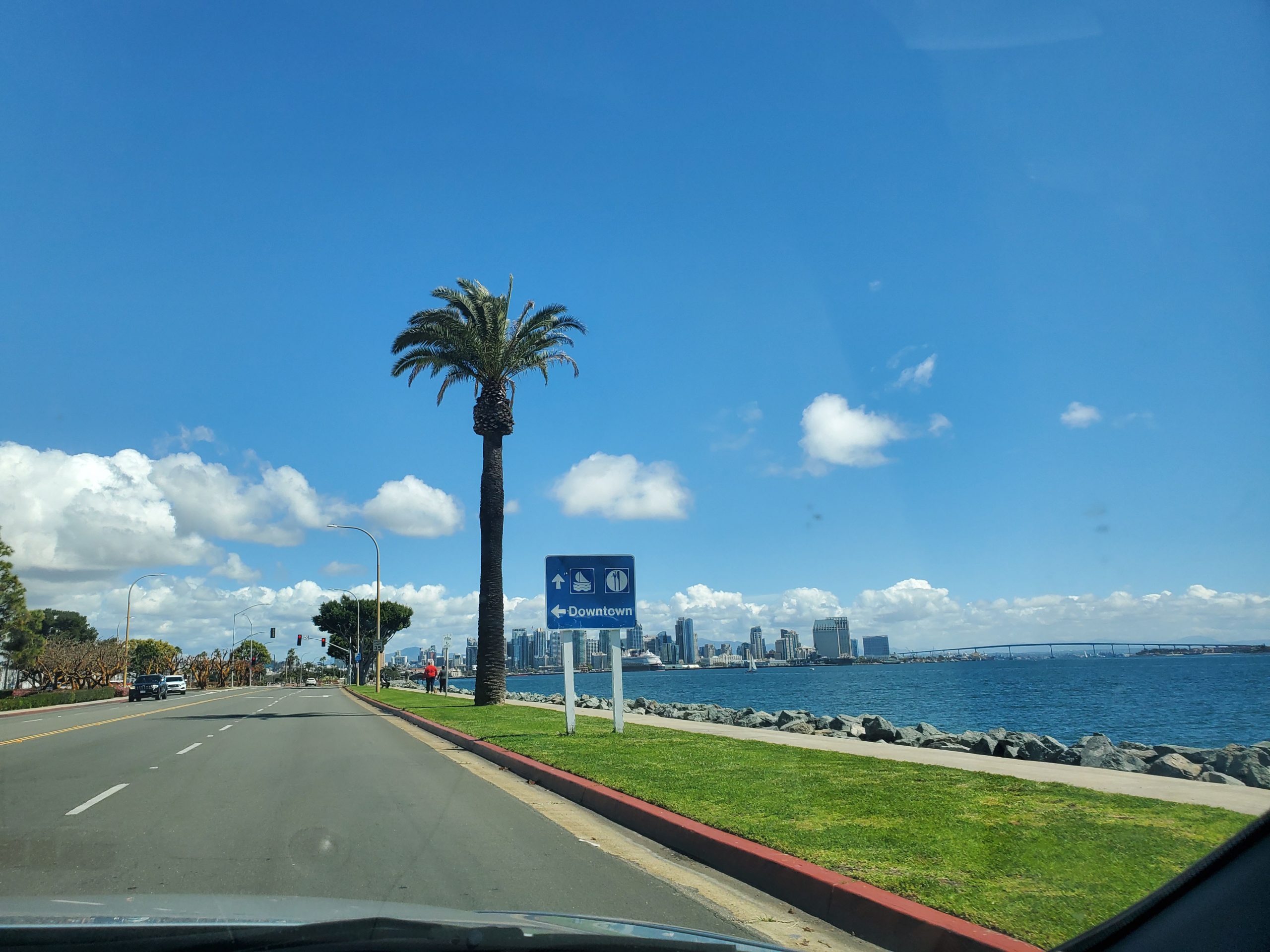
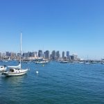
The drive starts at the intersection of Broadway and Harbor Drive in downtown San Diego. This is the Broadway Pier area right along the San Diego Harbor which includes some key attractions including the USS Midway Museum and the Maritime Museum of San Diego. This is where cruise ships dock in San Diego.
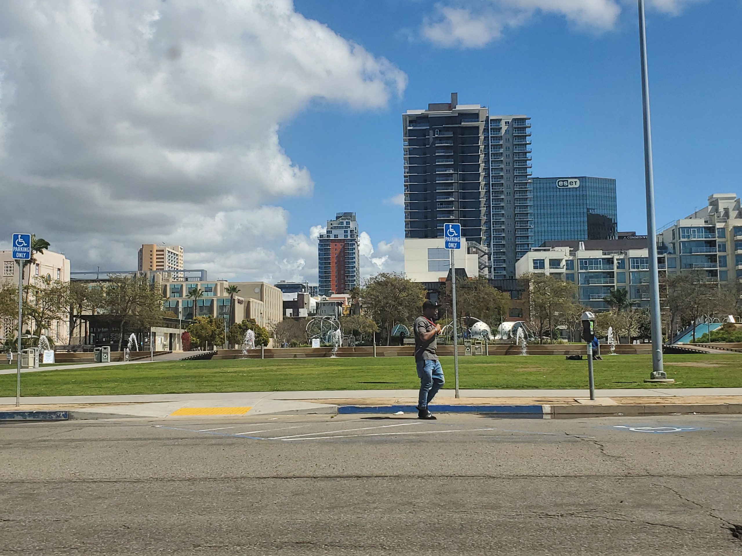
Broadway Pier is a prime area for outdoor recreation, especially walking or biking. Next to the USS Midway Museum you will find the Greatest Generation Walk (actually more of a park). A short distance south on Harbor Drive is Seaport Village, home to shops, restaurants and hotels. On the right side of Harbor Drive is the San Diego County Administration Center that features an outdoor water park.
The route along Harbor Drive heads directly towards the airport. The Scenic Drive signs with the iconic seagull start to mark the route. The first turn is directly across from the airport heading left on Harbor Island.
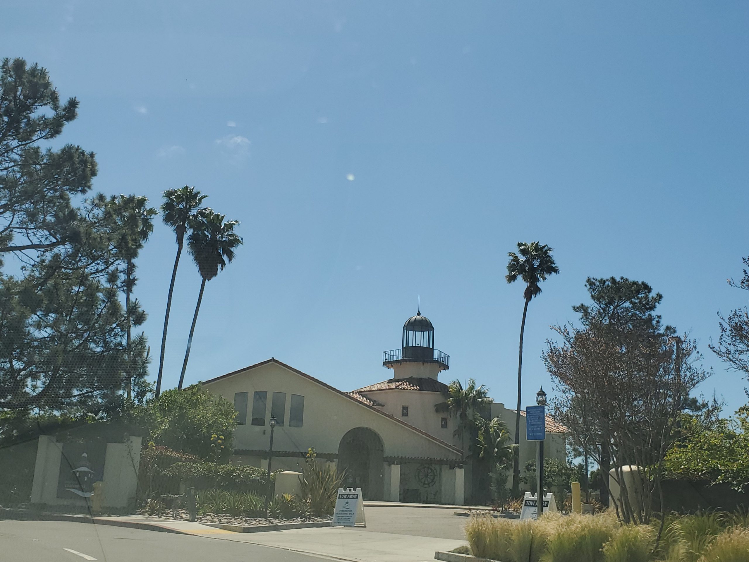
Harbor Island is a small man-made island with great views of downtown San Diego and the navy base at Coronado. There are likely to be aircraft carriers and other ships in port at Coronado. The road enters Harbor Island in the center. The drive loops around the short island. There are restaurants, hotels and walking paths all along the island. At the west end is Tom Ham’ Lighthouse restaurant. The east end is home to several restaurants from the popular Cohn Group.
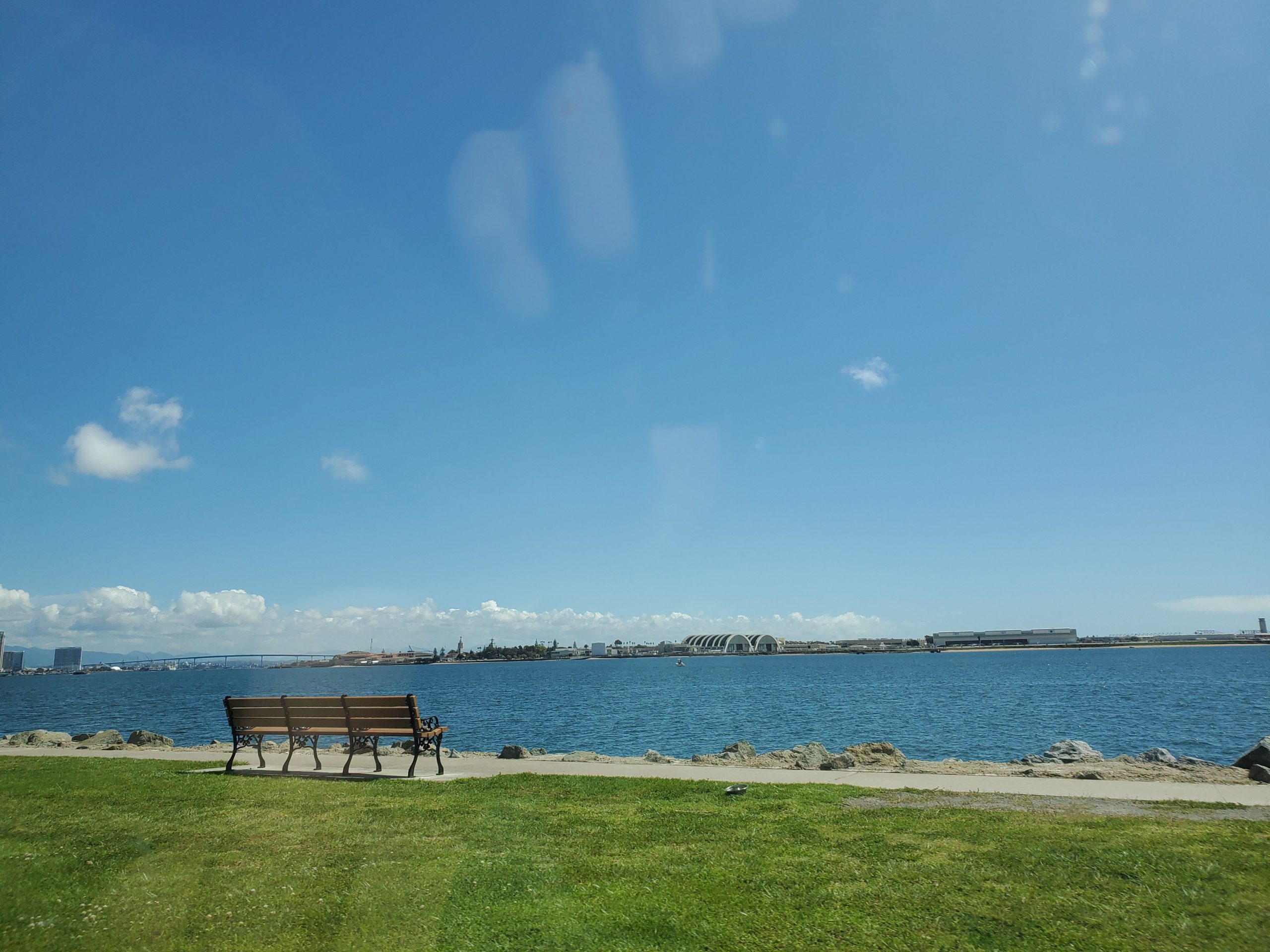
Harbor Island only has one entrance/exit so the drive continues by making a left back on Harbor Drive by the airport entrance. This route is one of San Diego’s favorite biking spots. The popular bike trail goes from Liberty Station by the airport to downtown San Diego at the Broadway Pier.
Harbor Drive continues past the airport to Scott Street where you make a left. This is the start of the Point Loma area of San Diego.
Point Loma/Ocean Beach
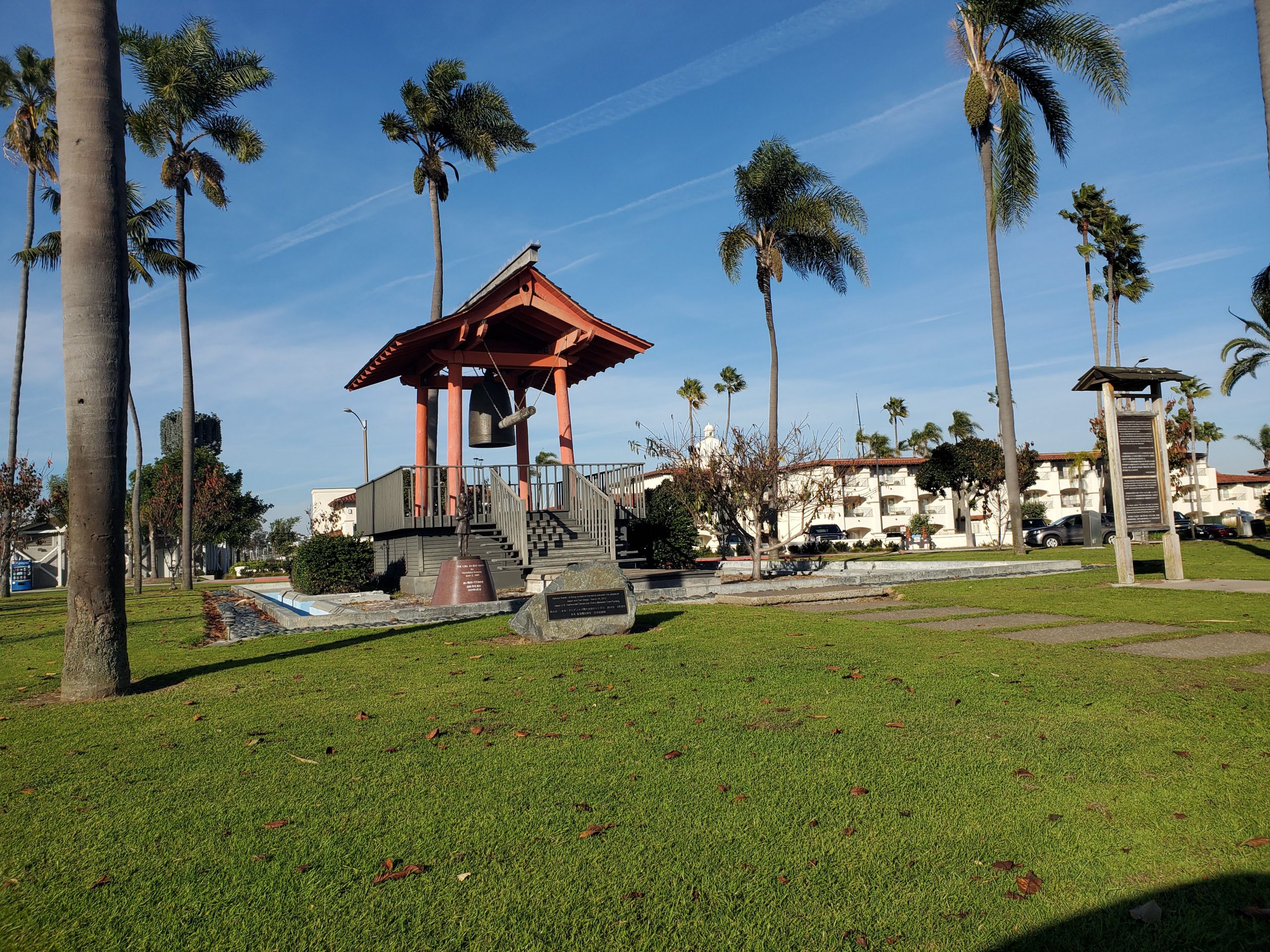
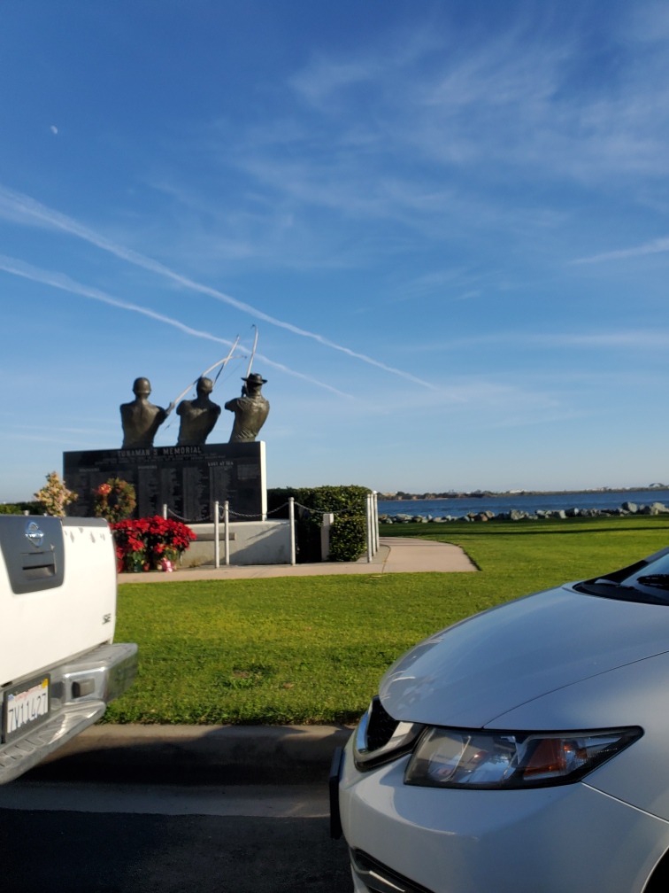
Point Loma is a hilly peninsula that separates the San Diego Bay from the Pacific Ocean. This portion of the 59-Mile Scenic Drive goes along the bay side of Point Loma. The first stop is a left turn on Shelter Island Drive. Like Harbor Island, Shelter Island is a short man-made island. At the tip of Shelter Island you will make a loop around the Yokohama Friendship Bell. Yokohama, Japan is a sister city of San Diego. On your right as you drive back you will see the Tunaman’s Memorial, honoring San Diego’s tuna industry.
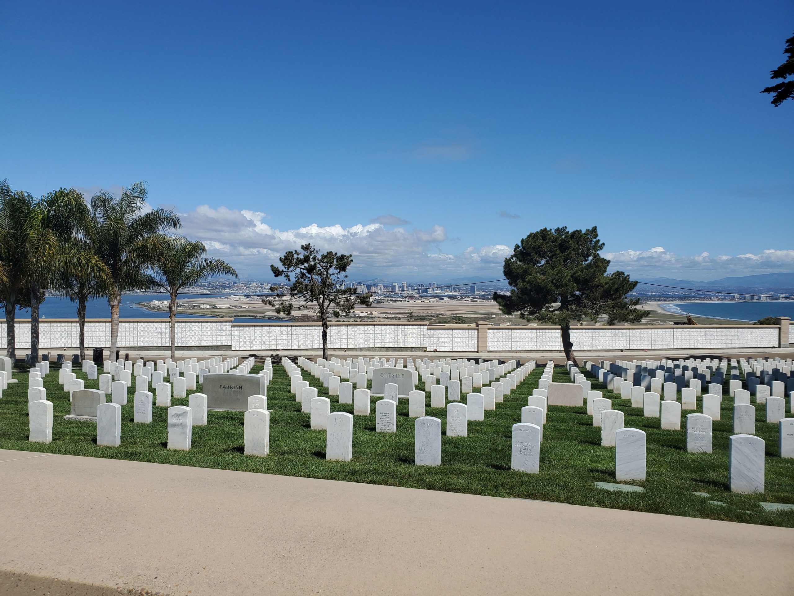
The exit/entrance to Shelter Island takes you back to Scott Street where the route by continues with a left on Scott. A short distance down Scott, the drive turns right on Talbot Street and heads to the top of Point Loma. At the top of the hill Talbot bears left on Canon Street, and continues to go left on Catalina Boulevard. This heads straight out to the end of Point Loma at Cabrillo National Monument.
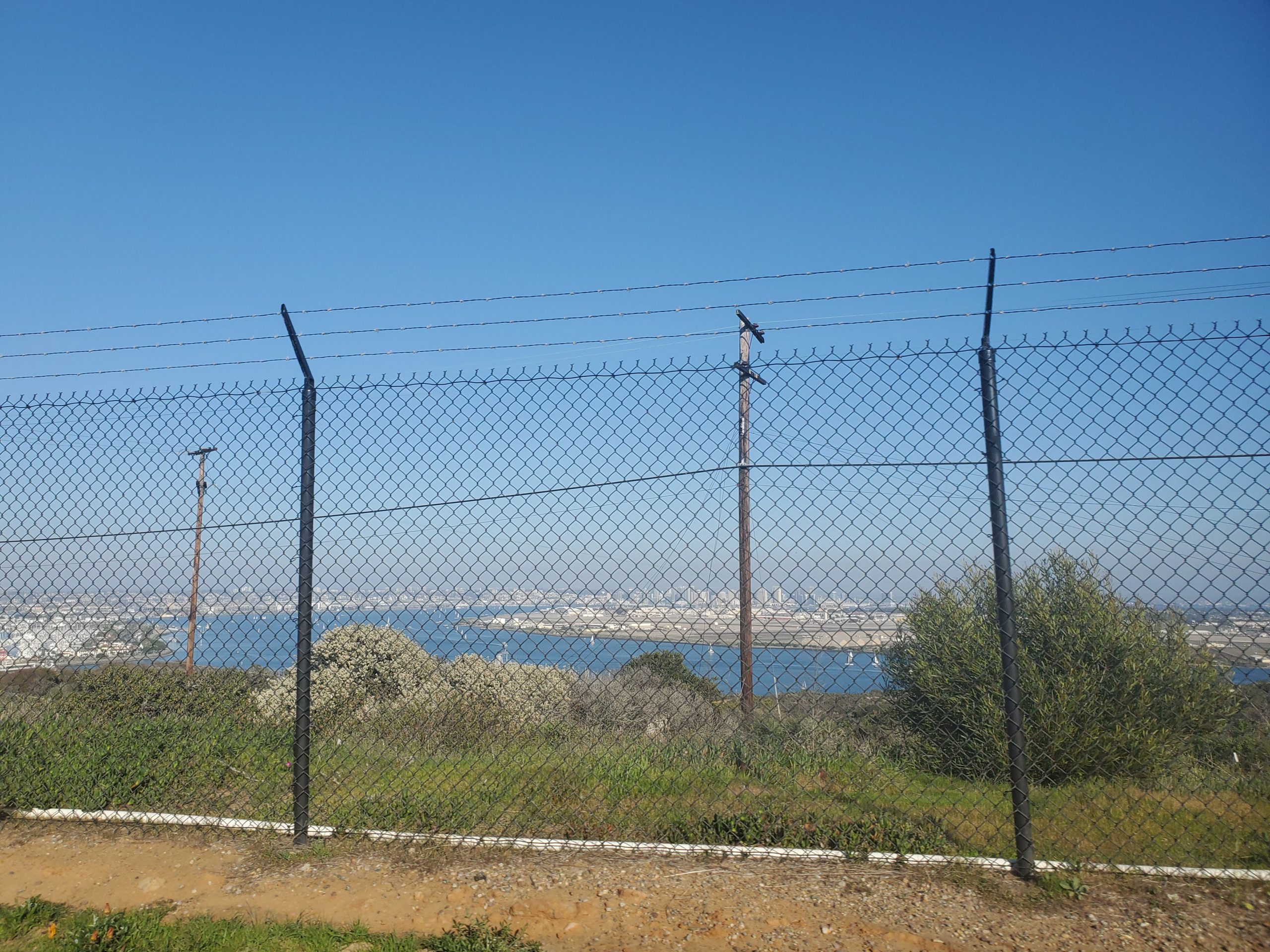
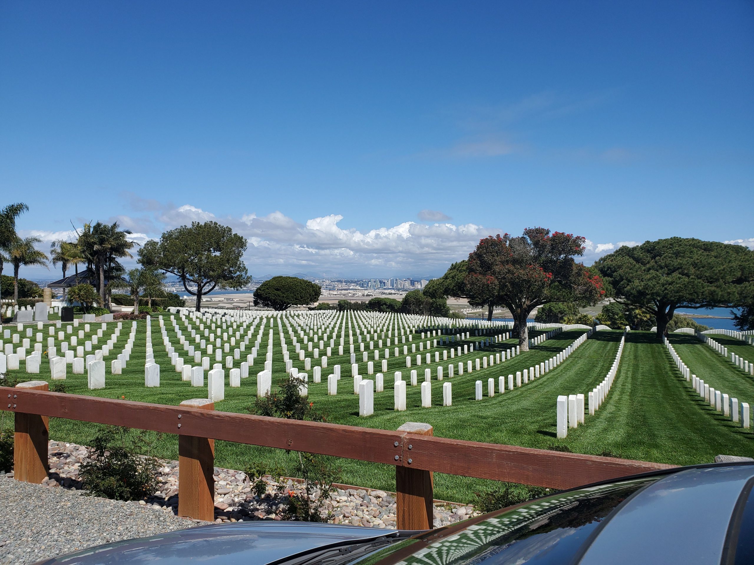
Catalina Boulevard provides sweeping views of San Diego and Coronado. The road passes directly through the Point Loma Naval Base and Fort Rosecrans Cemetery. It ends at Cabrillo National Monument. Cabrillo National Monument and its tide pools are definitely worth a visit but it can get crowded on weekends during low tide and whale season (the winter).
At Cabrillo, the Point Loma peninsula ends and the drive goes back along Catalina Boulevard. Just past the intersection on the right with Canon and Talbot St, the 59-Mile Scenic Drive makes a left onto Hill St.
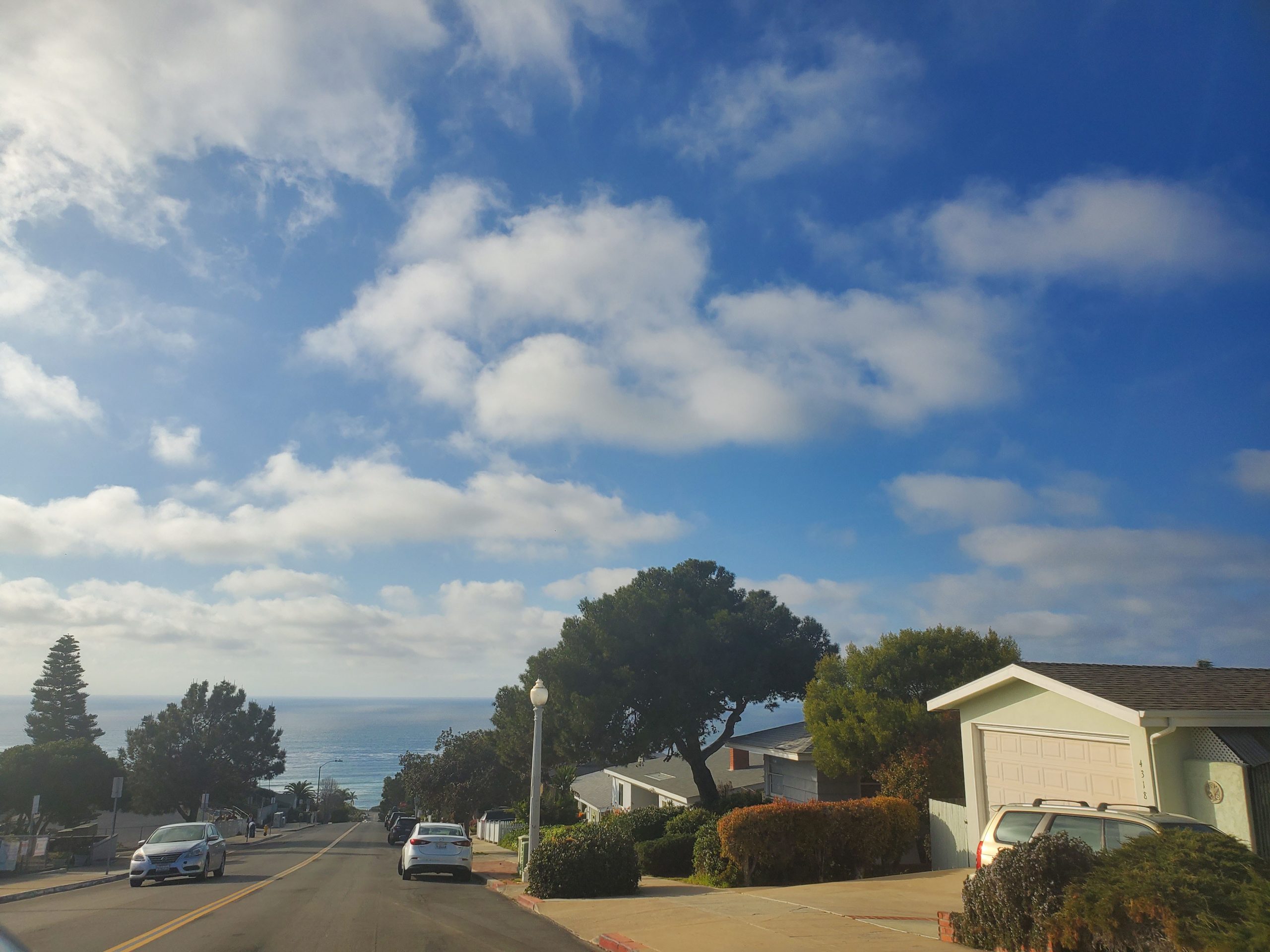
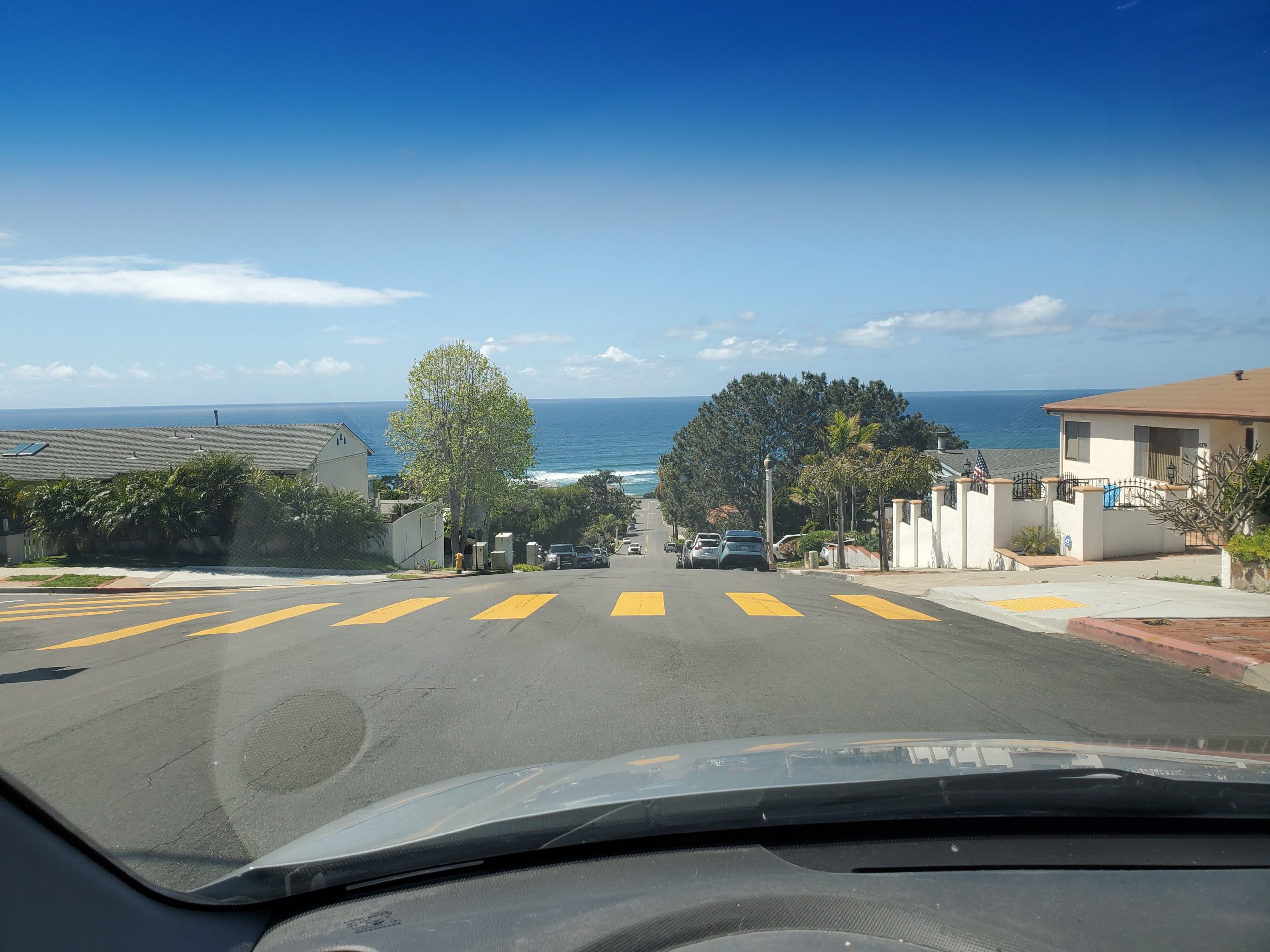
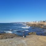
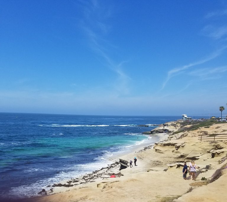
Hill Street goes downhill towards the Pacific Ocean. It ends at Sunset Cliffs Boulevard where the drive turns right, heading north along the coast. Sunset Cliffs is one of San Diego’s most scenic coastal areas. This is a great place for a hike along the cliffs.
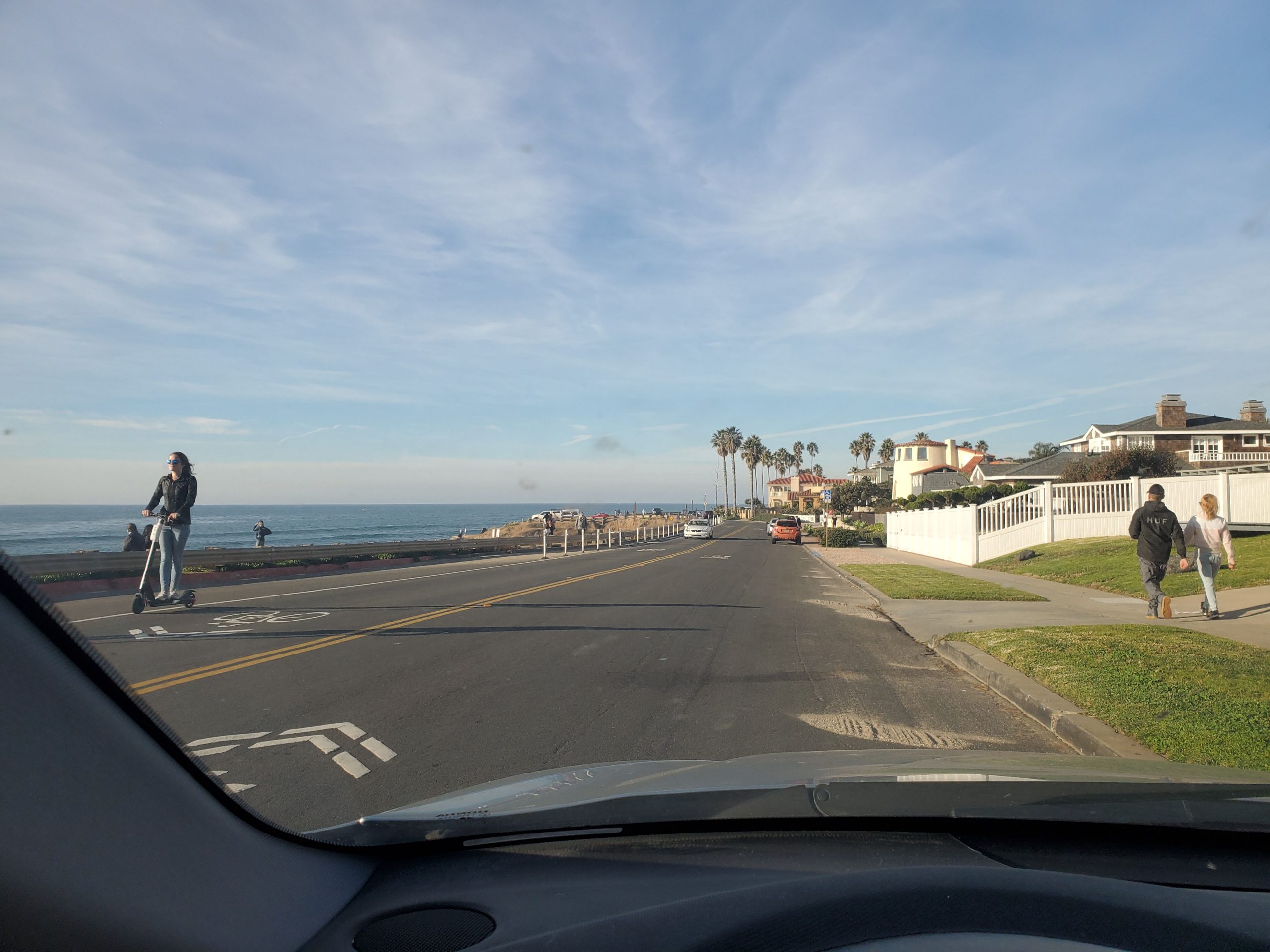
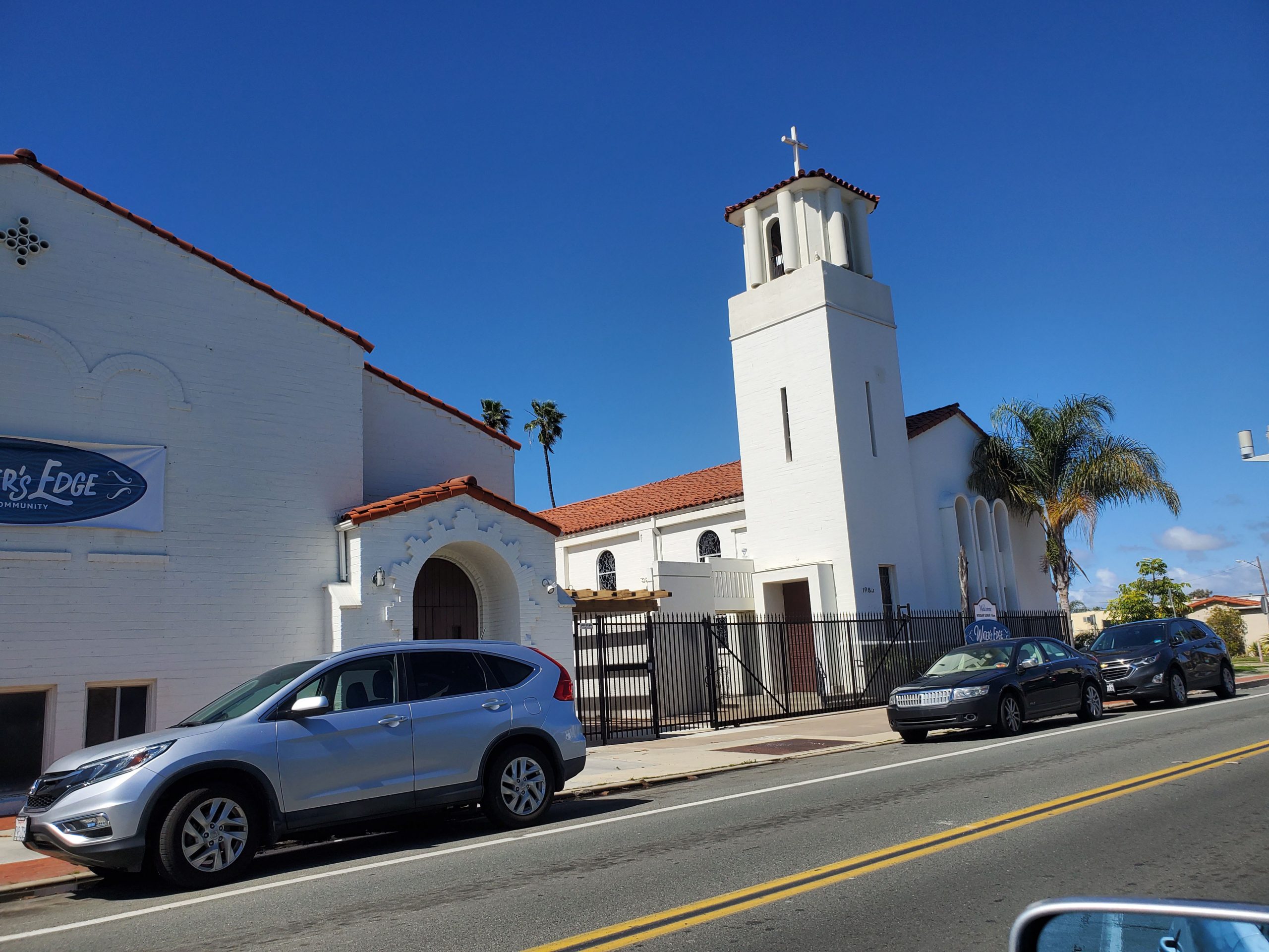
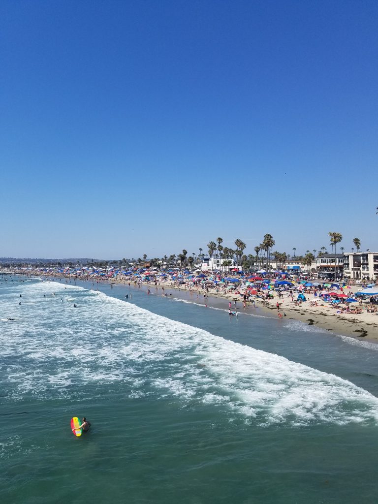
Sunset Cliffs heads through the Ocean Beach (OB) community at the northwest end of Point Loma. Ocean Beach is an eclectic neighborhood that Thrillist named as one of coolest neighborhoods in the U.S. to spend a weekend. Most of the OB action can be found turning left on Newport Avenue which ends at the pier.
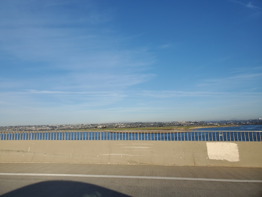
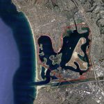
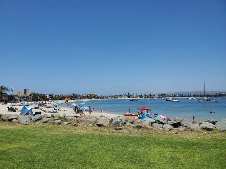
Sunset Cliffs Boulevard ends at the San Diego River. From here the 59-Mile Scenic Drive reaches a busy section where several roads intersect. The route follows West Mission Bay Drive across the river into Mission Bay Park.
Mission Bay
Mission Bay Park is a huge 4,600 acre bay with many parks, hotels, restaurants and SeaWorld. During this part of the drive Sunset Cliffs becomes Sea World Drive as it crosses the bridge into Mission Bay. The drive exits onto W. Mission Bay Drive which becomes Ingraham Street. The signs are well marked as the drive goes past SeaWorld through the heart of Mission Bay.
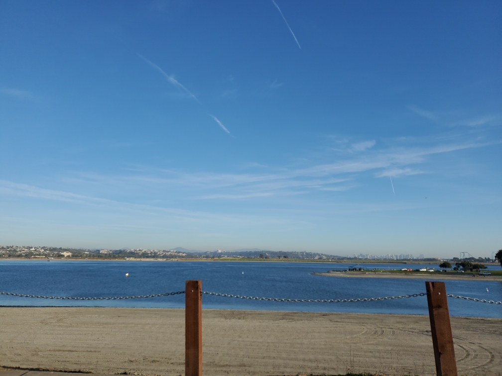
Past SeaWorld, Ingraham Street crosses a bridge to Paradise Point, a small island in the center of Mission Bay. A second bridge leads off the small island to the Crown Point Peninsula.
At the end of the bridge to Crown Point the 59-Mile Scenic Drive turns right on to Crown Point Drive, past Crown Point Park. This entire area is one of the best bike riding spots in all of San Diego. This includes a 12-mile bike route around the bay (we usually start at Crown Point Park).
At the end of Crown Point Park, the route makes a left on Lamont Street. Lamont Street goes through the residential district of Pacific Beach, one of San Diego largest communities. Past Beryl Street, the road starts to go uphill into La Jolla. Lamont Street becomes Soledad Road.
Mount Soledad
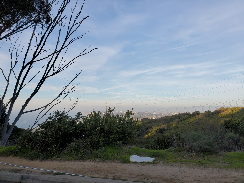
At the start of Soledad Road is Kate Sessions Park. This is a great picnic spot with views of the Mission Bay and downtown San Diego. Soledad Road continues up the hill until it ends at Soledad Mountain Road.
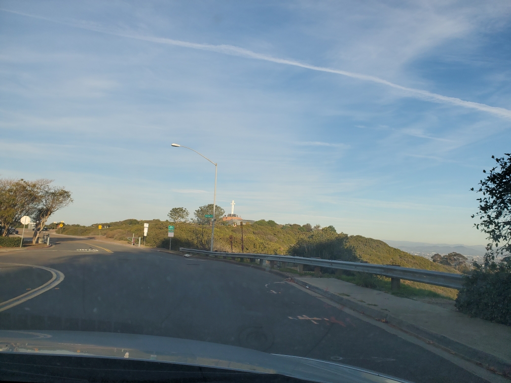
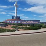
Making a left on Soledad Mountain Road heads to the top of the hill where the route turns right on La Jolla Scenic Drive. The top of the mountain is dominated by Mt. Soledad National Veterans Memorial. This spot provides some of the best 360 degree views of the San Diego area. Not only can is there a view of the entire city of San Diego, but clear days have views of distant mountains that are often snow capped in the winter. Also visible are islands off the shores of San Diego.
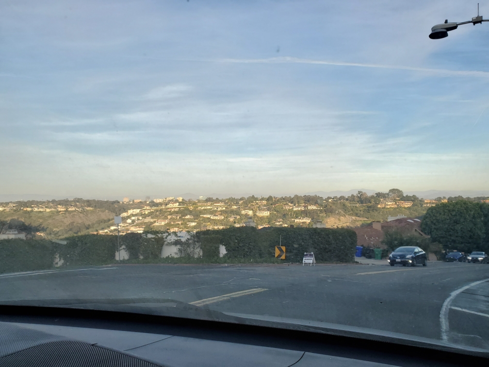
From Mt. Soledad, the road turns downhill on Via Capri (La Jolla Scenic Dr becomes Via Capri. The twisty road goes down the north side of Mt. Soledad providing spectacular views of the La Jolla coast and the University of California San Diego (UCSD). The hillside contains some of San Diego’s most expensive real estate.
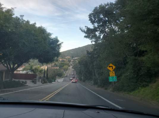
Near the bottom of Mt. Soledad, Via Capri makes a left turn on Hidden Valley Road. Hidden Valley Road goes to one of San Diego’s busiest intersections. This is the bottom of a canyon where the freeway becomes La Jolla Parkway. The 59-Mile Scenic Drive crosses La Jolla Parkway to Torrey Pines Road which forks slightly uphill to the right.
UCSD/Torrey Pines
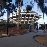
Torrey Pines Road goes up to the University of California San Diego (UCSD) campus. At the entrance to the UCSD campus, Torrey Pines Road ends at the intersection of N. Torrey Pines Road and La Village Drive. The drive goes left on N Torrey Pines Drive along the UCSD campus.
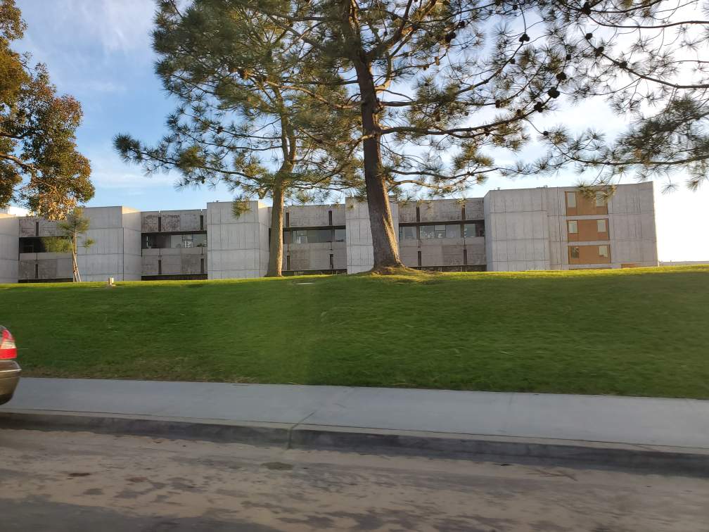
This area has some of the best hikes in the city of San Diego. UCSD is home to the outdoor Stuart Collection walk. Near the intersection of Torrey Pines and La Jolla Village Drive you may be able to see the big Red Shoe, one of the exhibits on the Stuart Walk.
The official 59-Mile Scenic Drive ends near the Scripps Aquarium and La Jolla Shores Drive. However, we like to continue a short distance north to the Torrey Pines Gliderport at the intersection of N Torrey Pines Rd and Torrey Pines Scenic Dr. This is a great place to end part 1 of the drive.
The intersection of N. Torrey Pines Rd and Torrey Pines Scenic Rd is home to the Salk Institute. Jonas Salk pioneered the polio vaccine. Because we did this during the coronavirus epidemic, this serves as a great reminder that through the efforts of schools like UCSD, humans have solved these problems in the past.
From here, the route starts to head back towards downtown. Part Two of the 59-Mile Scenic Drive goes through the heart of La Jolla and along the San Diego coast, before turning inland towards some of San Diego’s best parks.
One Comment
Comments are closed.