Big Bear Lake: Hiking Pine Knot Trail to Grand View
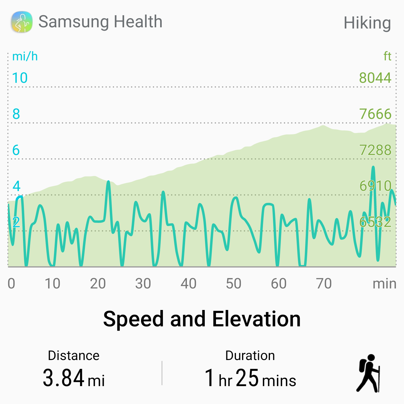
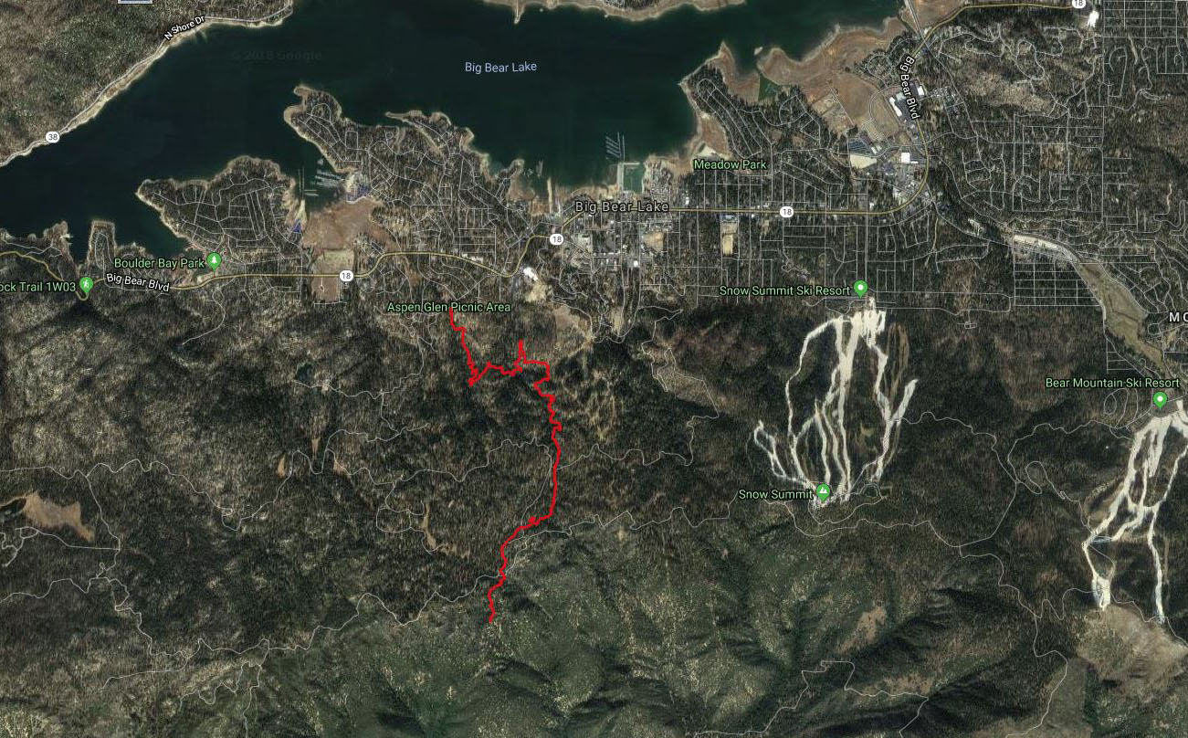
The hike up Pine Knot Trail to Grand View Point probably provides the most epic views in the San Bernardino mountain range. Starting from Big Bear Lake, this climbs about 1,000 feet to Grand View Point which overlooks a valley and the highest mountains in Southern California. Roundtrip it is a little over 7 miles, but it is never really steep. We feature this Pine Knot Trail guide as part of our series on Big Bear Lake hikes.
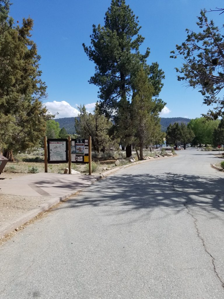
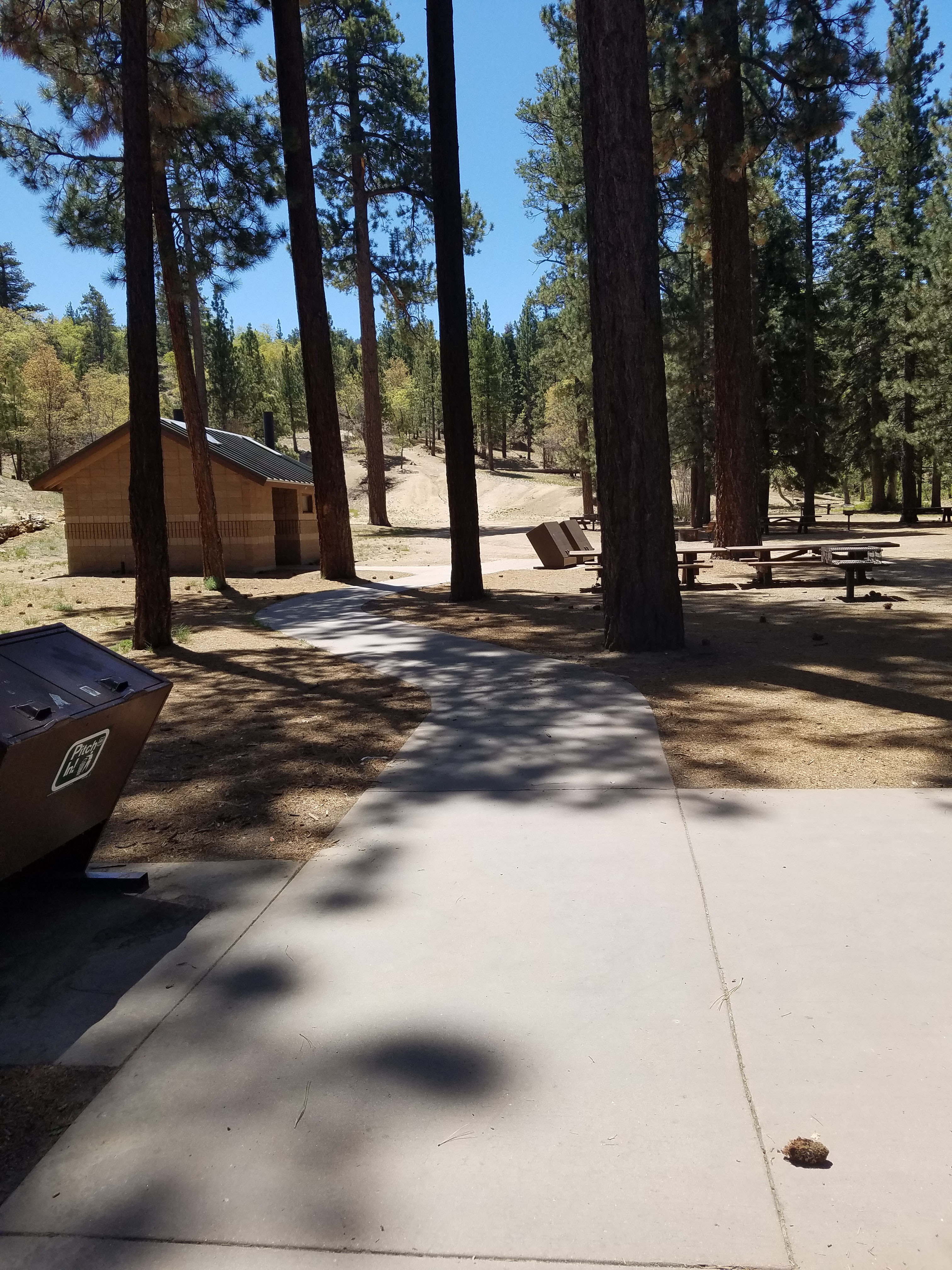
The Pine Knot Trail starts in the parking lot of the Aspen Grove Picnic area. There are full facilities here but you need an Adventure Pass to park. These passes cost $5 a day or $30 a year. You can purchase them at most gas stations and 7-11 stores in the Big Bear area.
- Starting Point: 40105 Mill Creek Rd, Big Bear Lake, CA 92315
- Length: 7.6 miles
- Elevation: 1050 ft gain and loss
- Type: Out-and-back
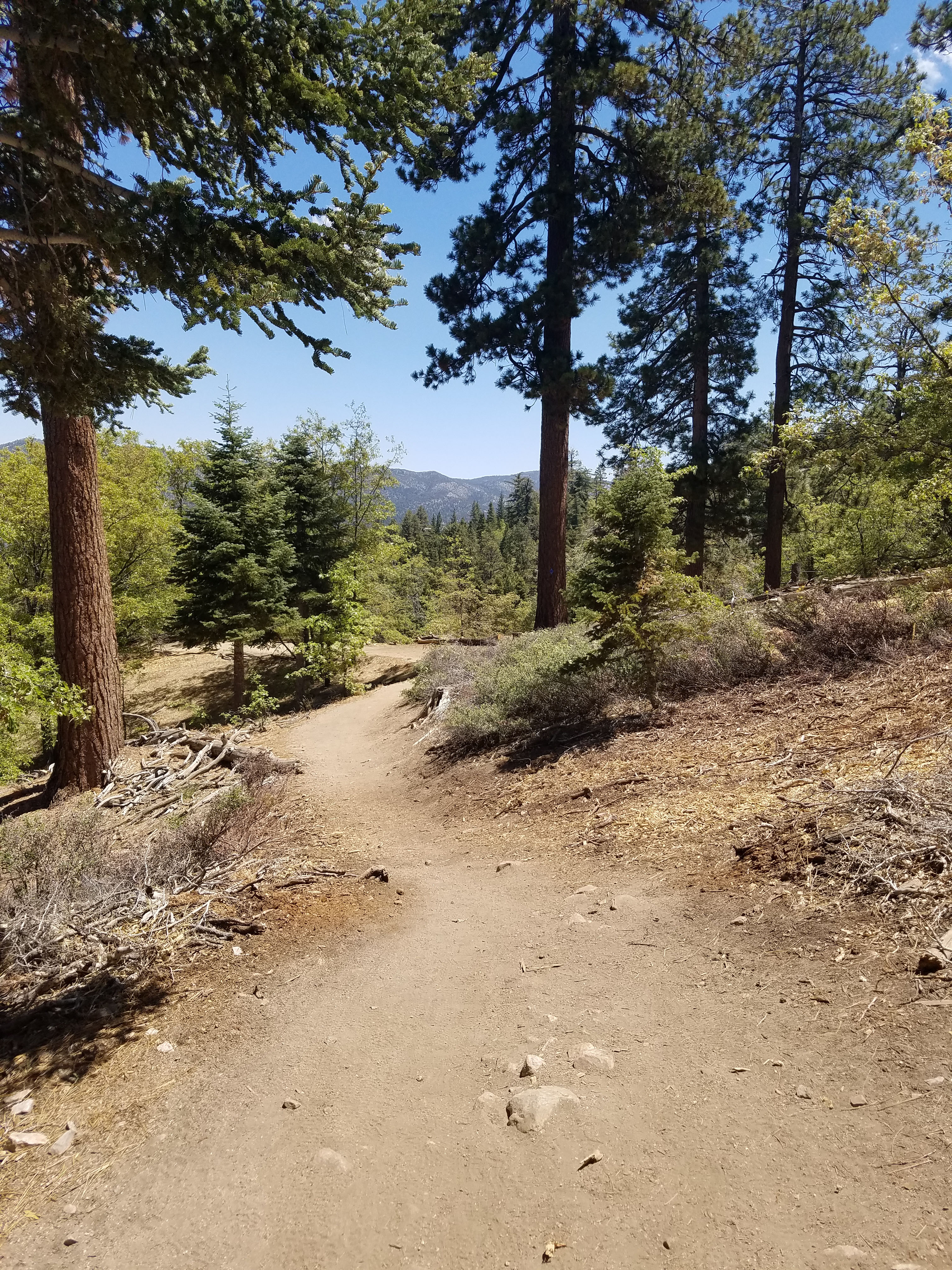
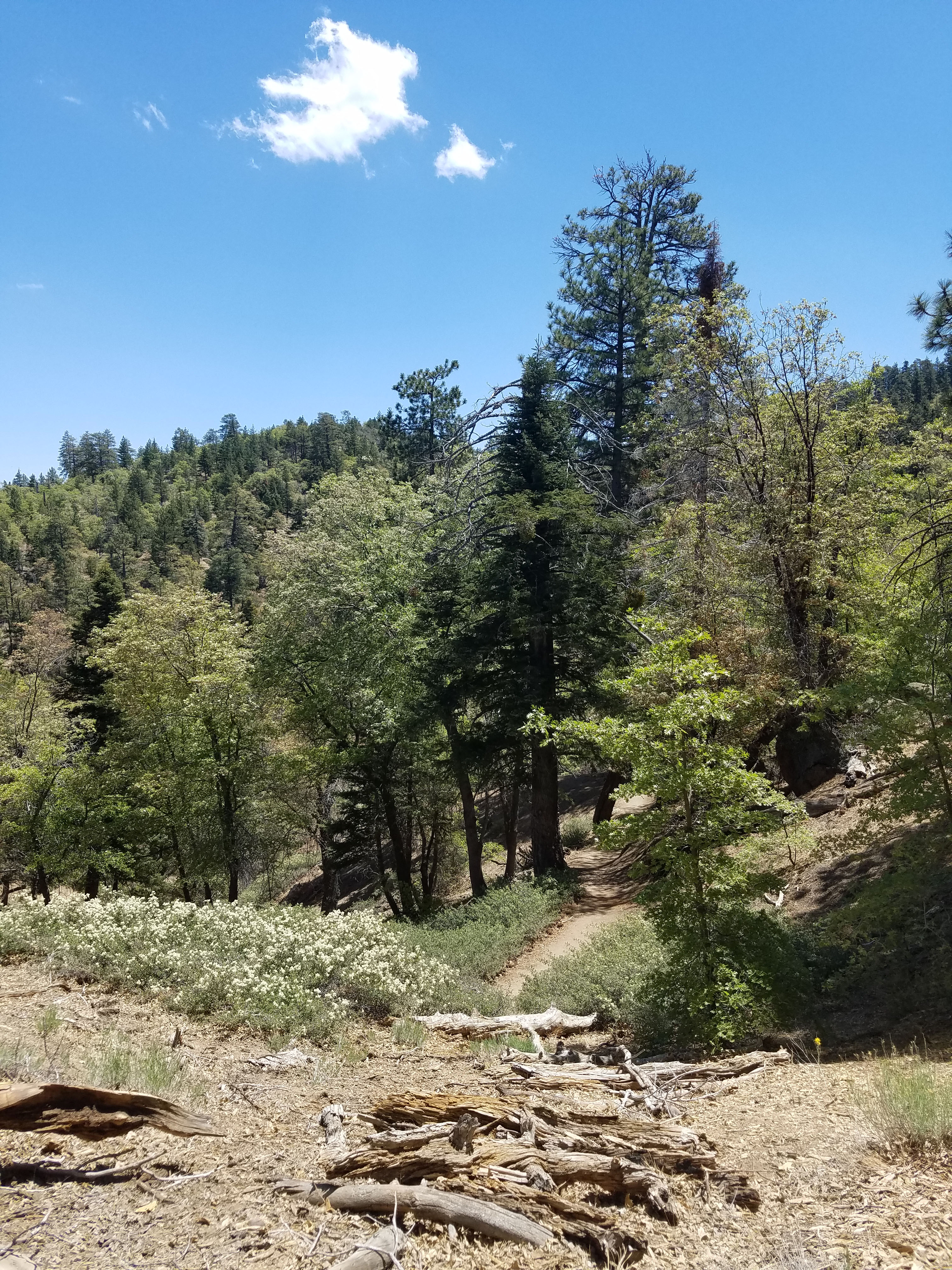
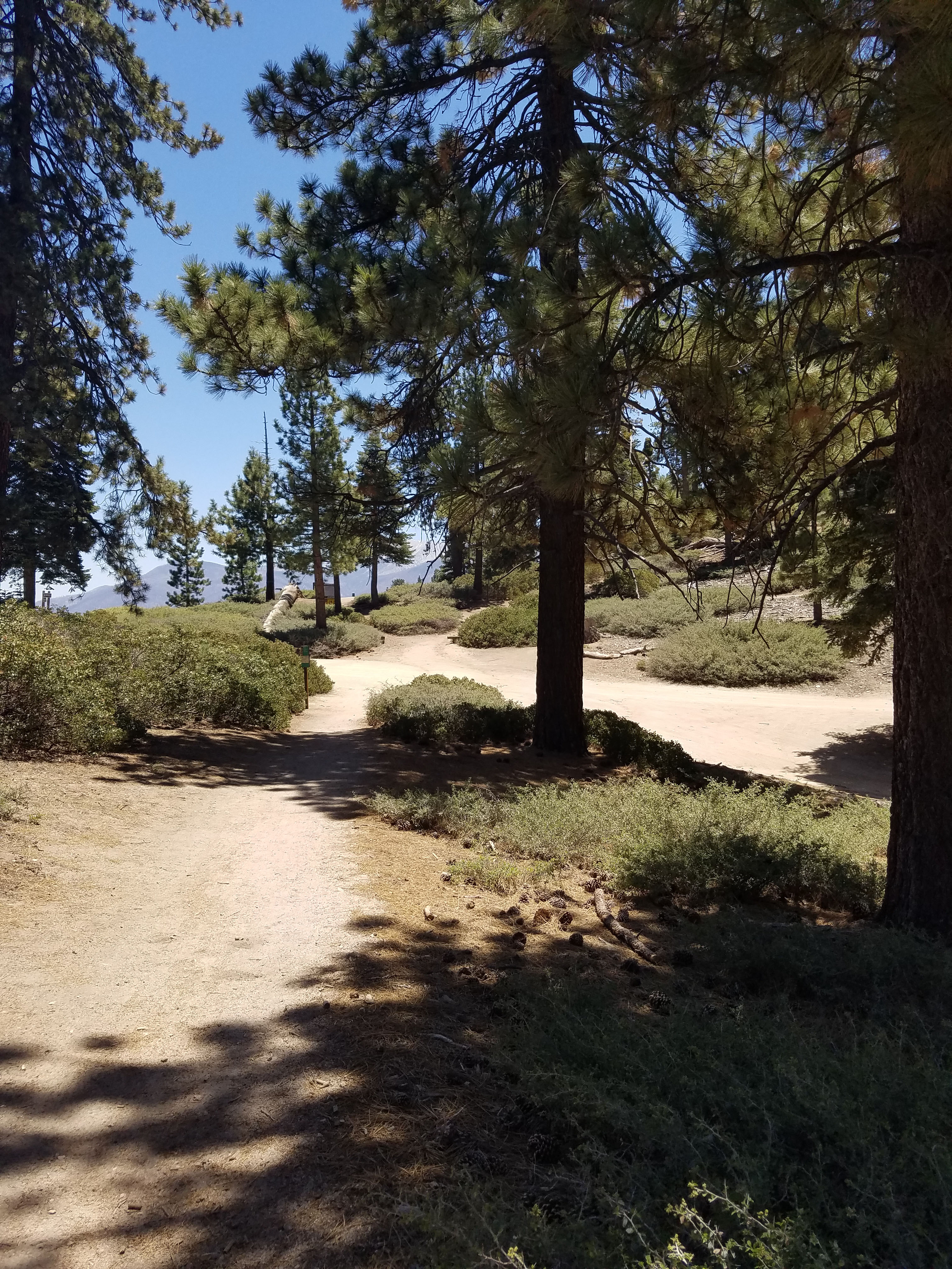
The trail starts at the back of the picnic area and it clearly marked. It starts to climb immediately but it is never very steep. There are many switchbacks. At some points the trail heads downhill for a bit before continuing the climb.
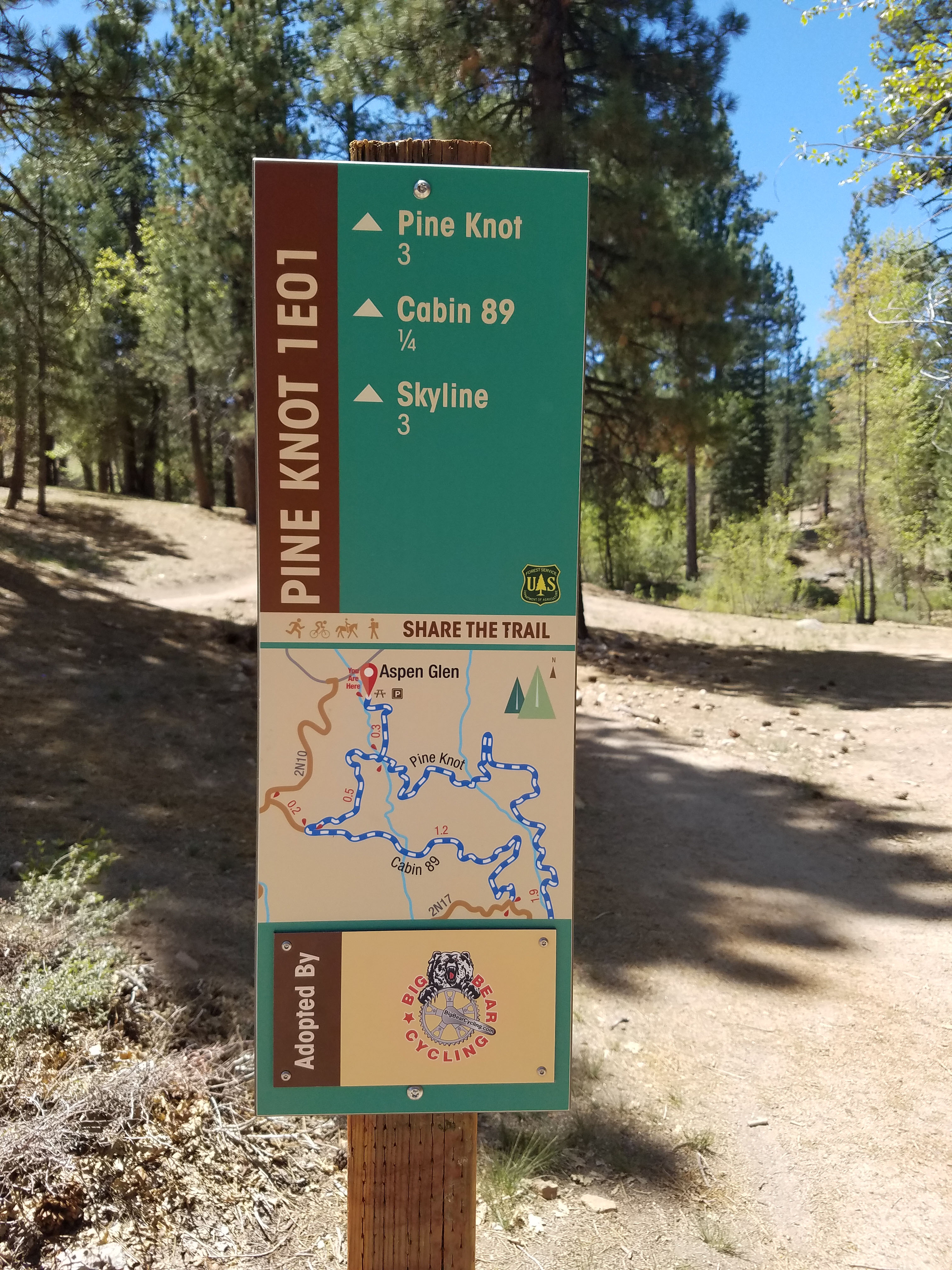
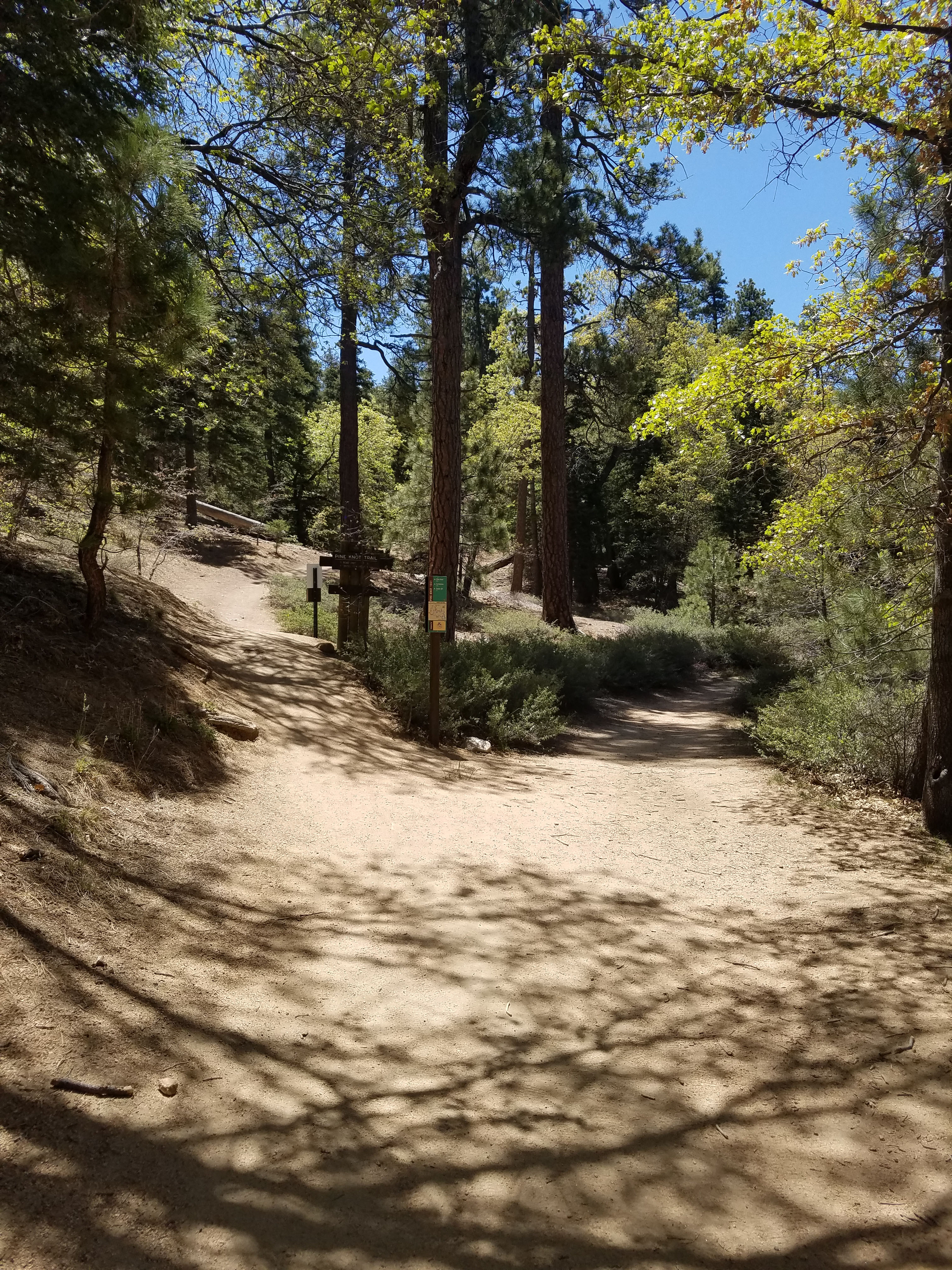
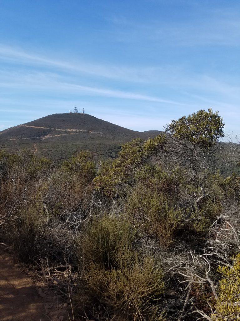
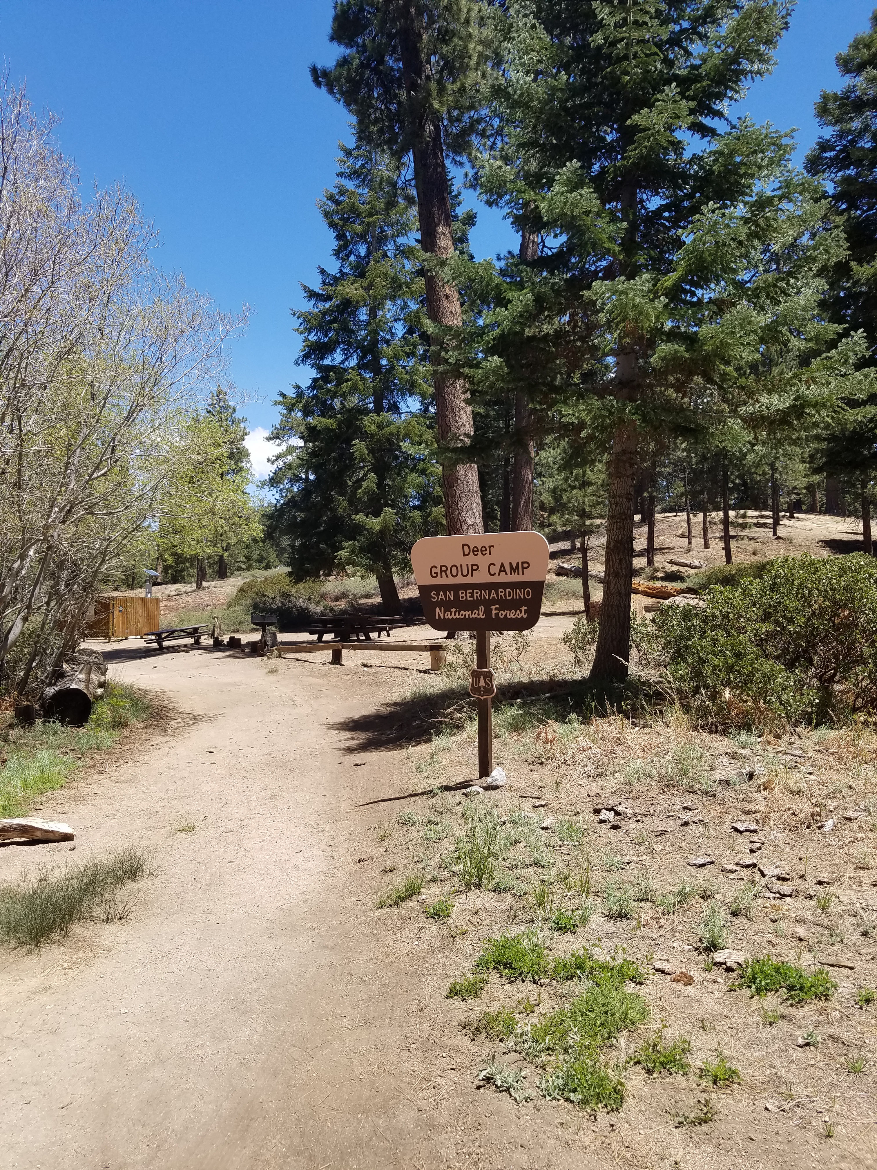
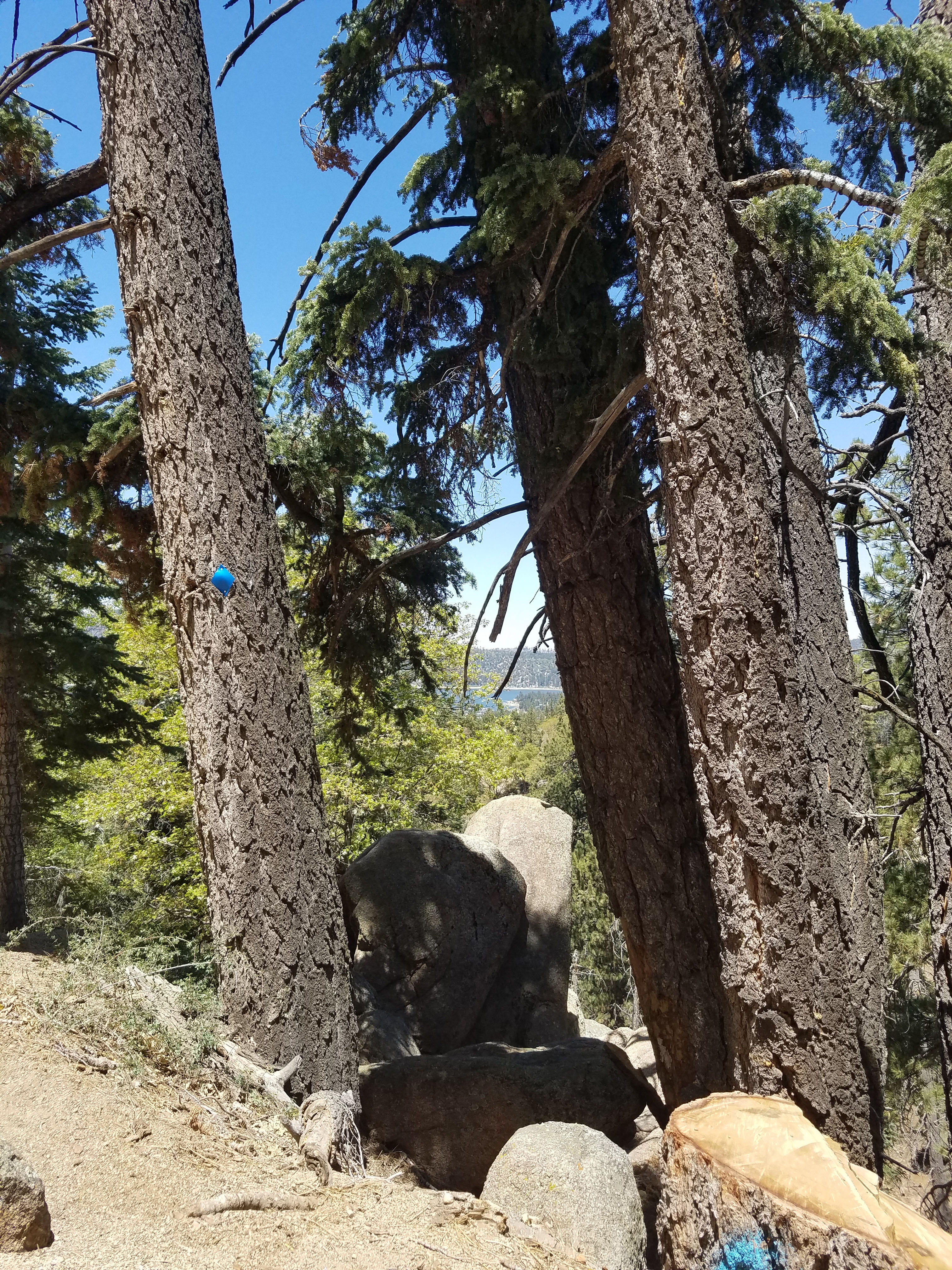
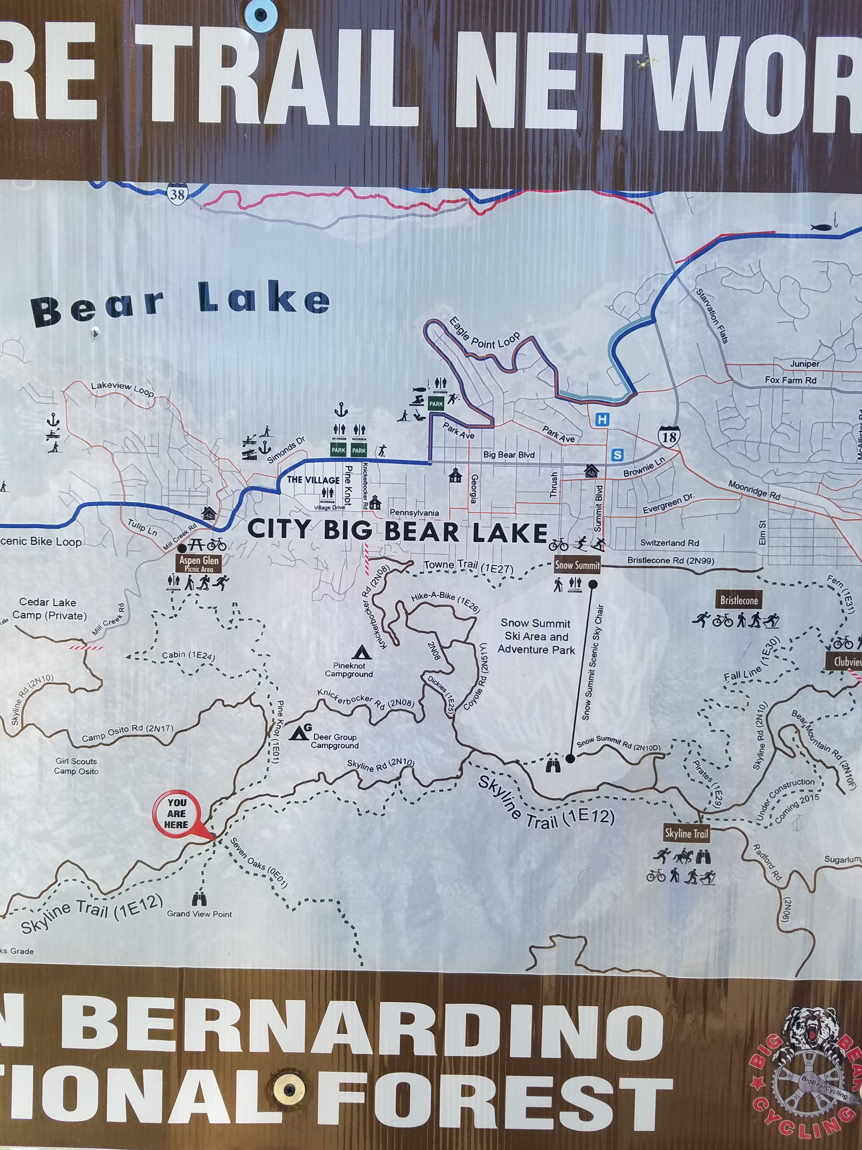
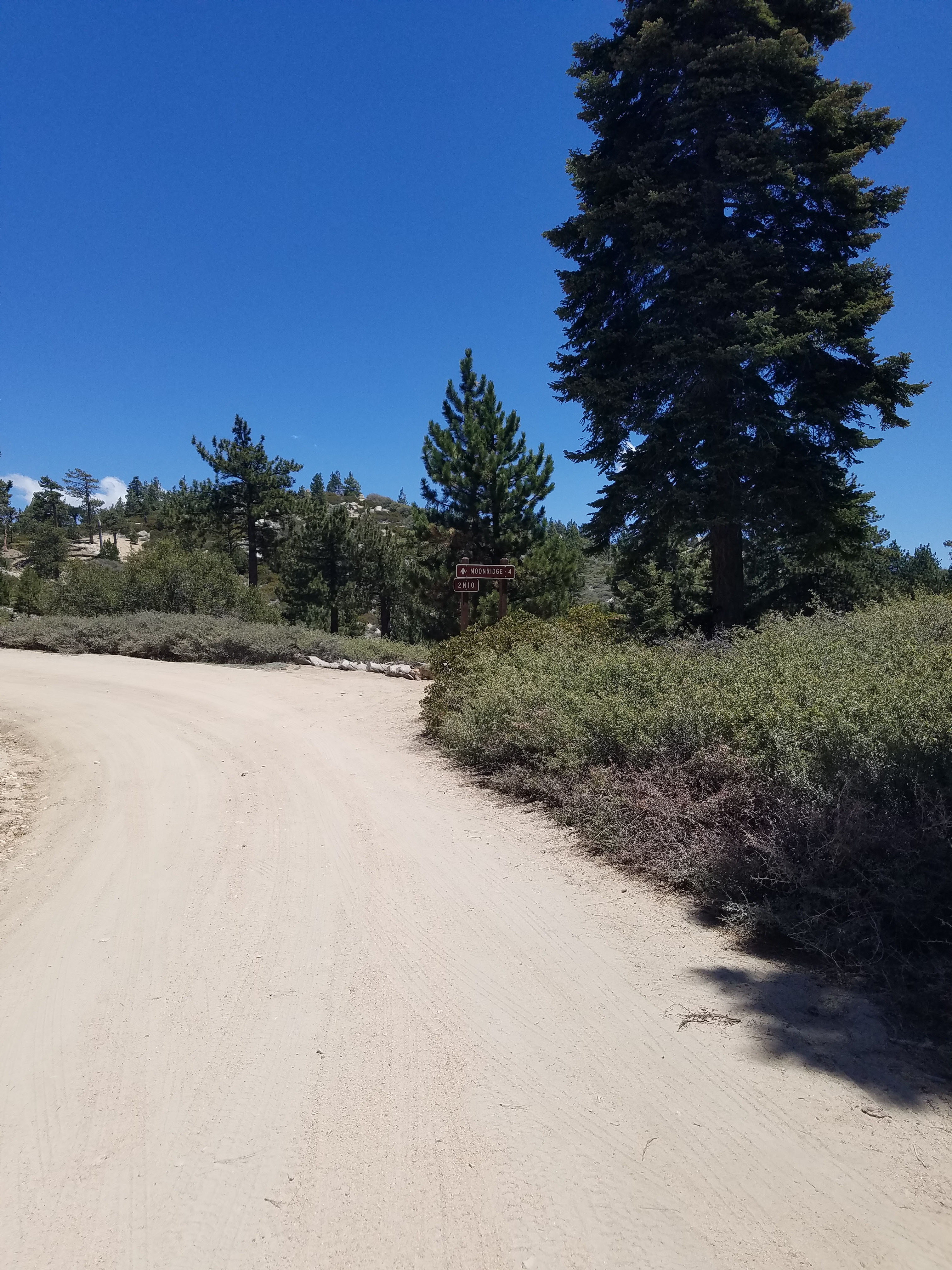
At close to two miles you will reach some of the service roads that head up the mountain. There is the Deer Group Campground which has picnic tables. There are plenty of signs marking the trail so it is easy to follow, even with the many side roads. If you are hiking in the snow there are even blue diamond signs on trees to mark the route.
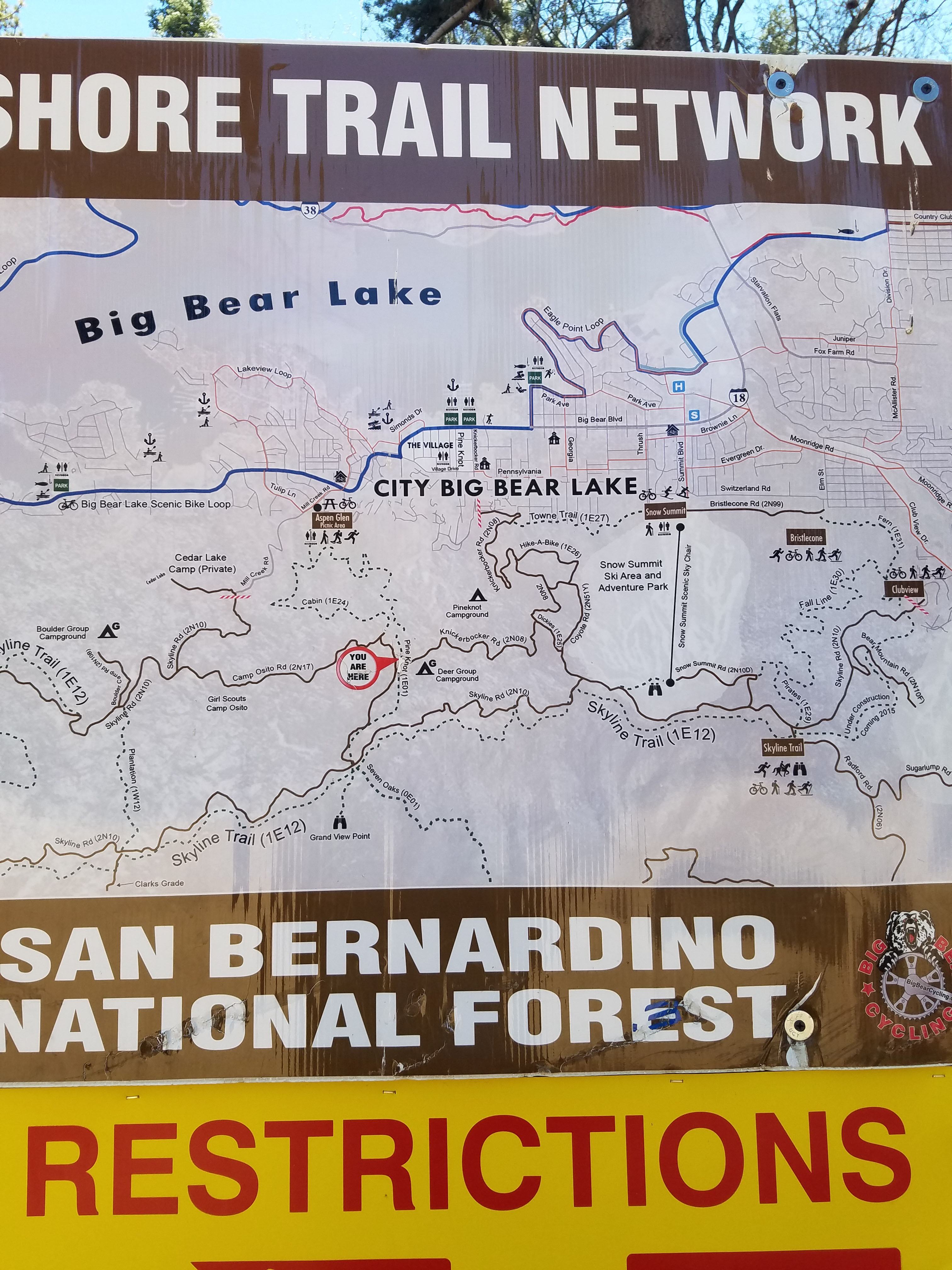
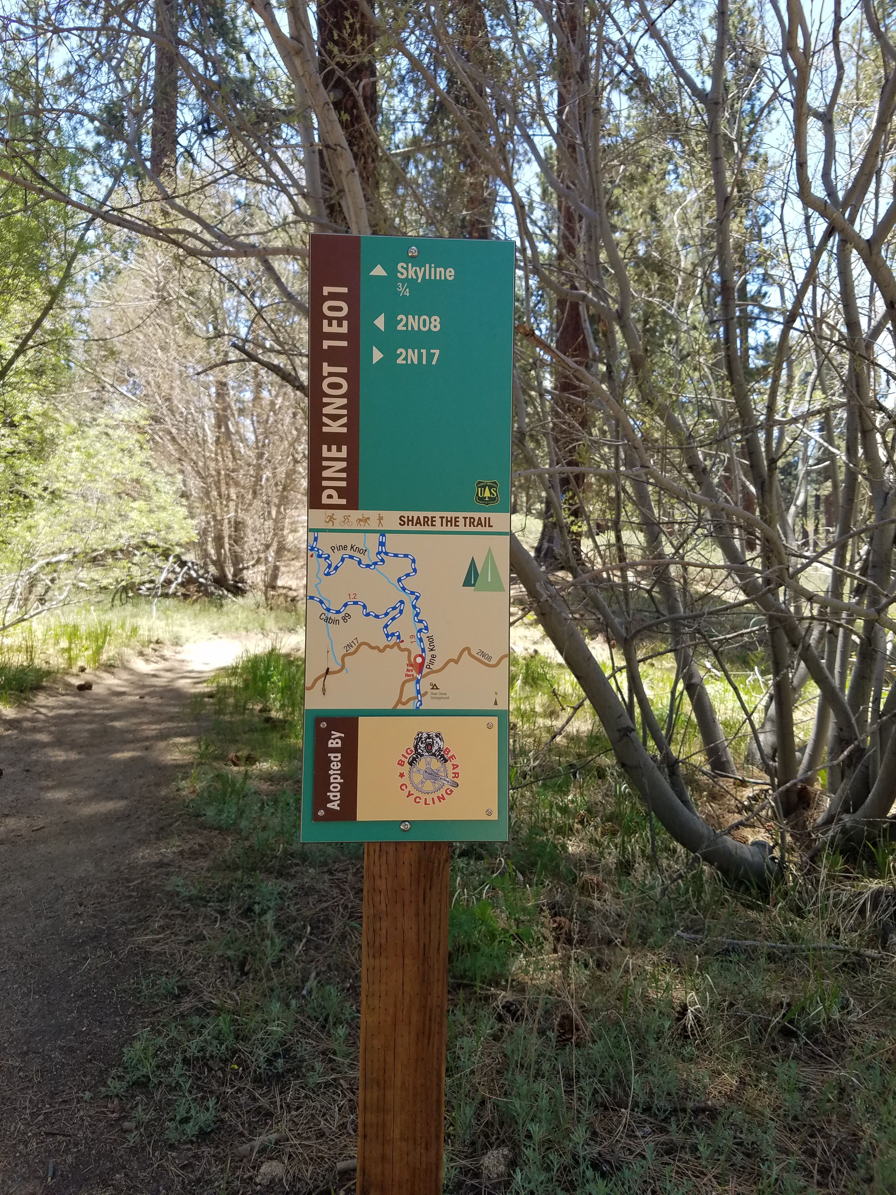
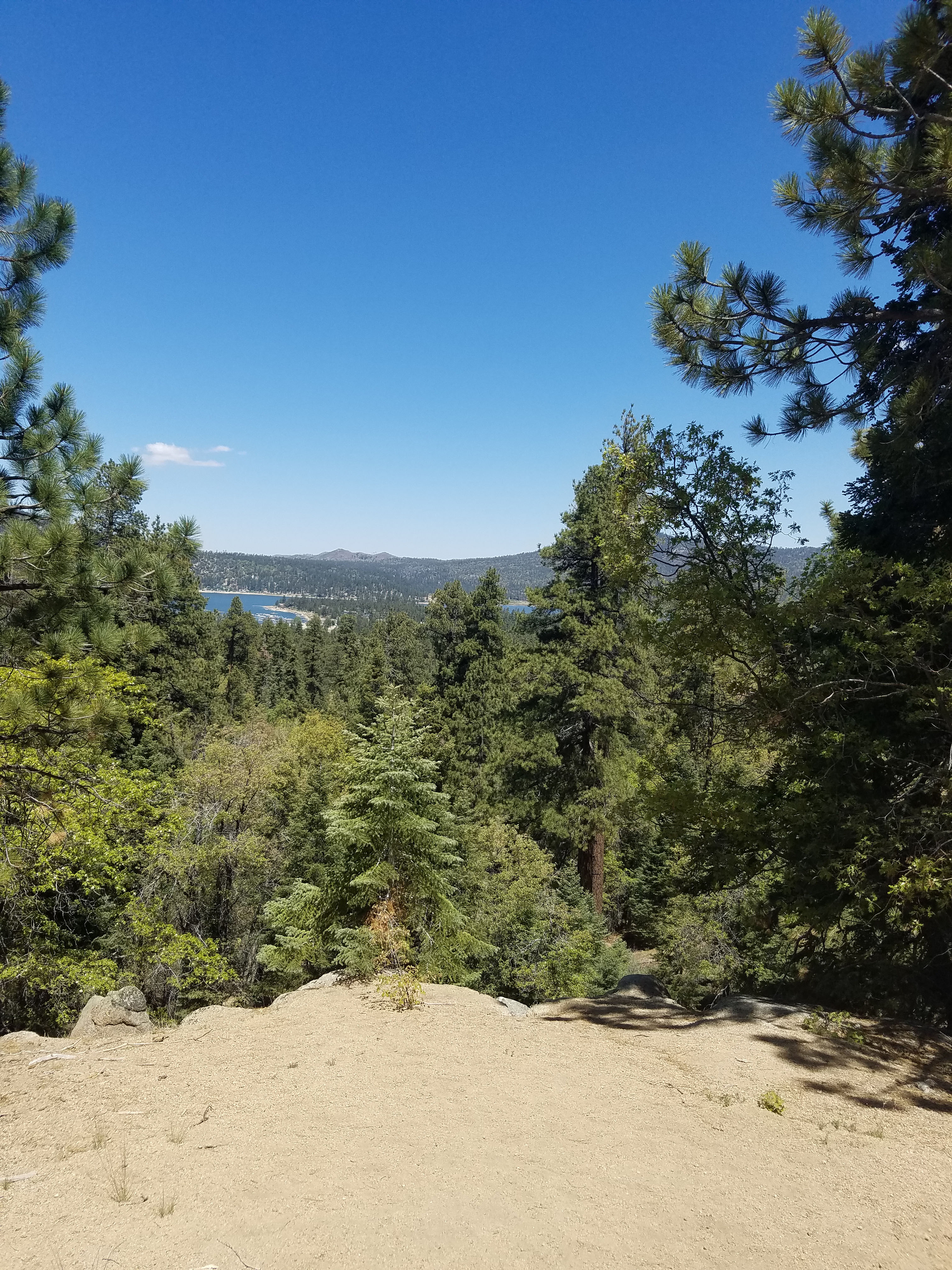
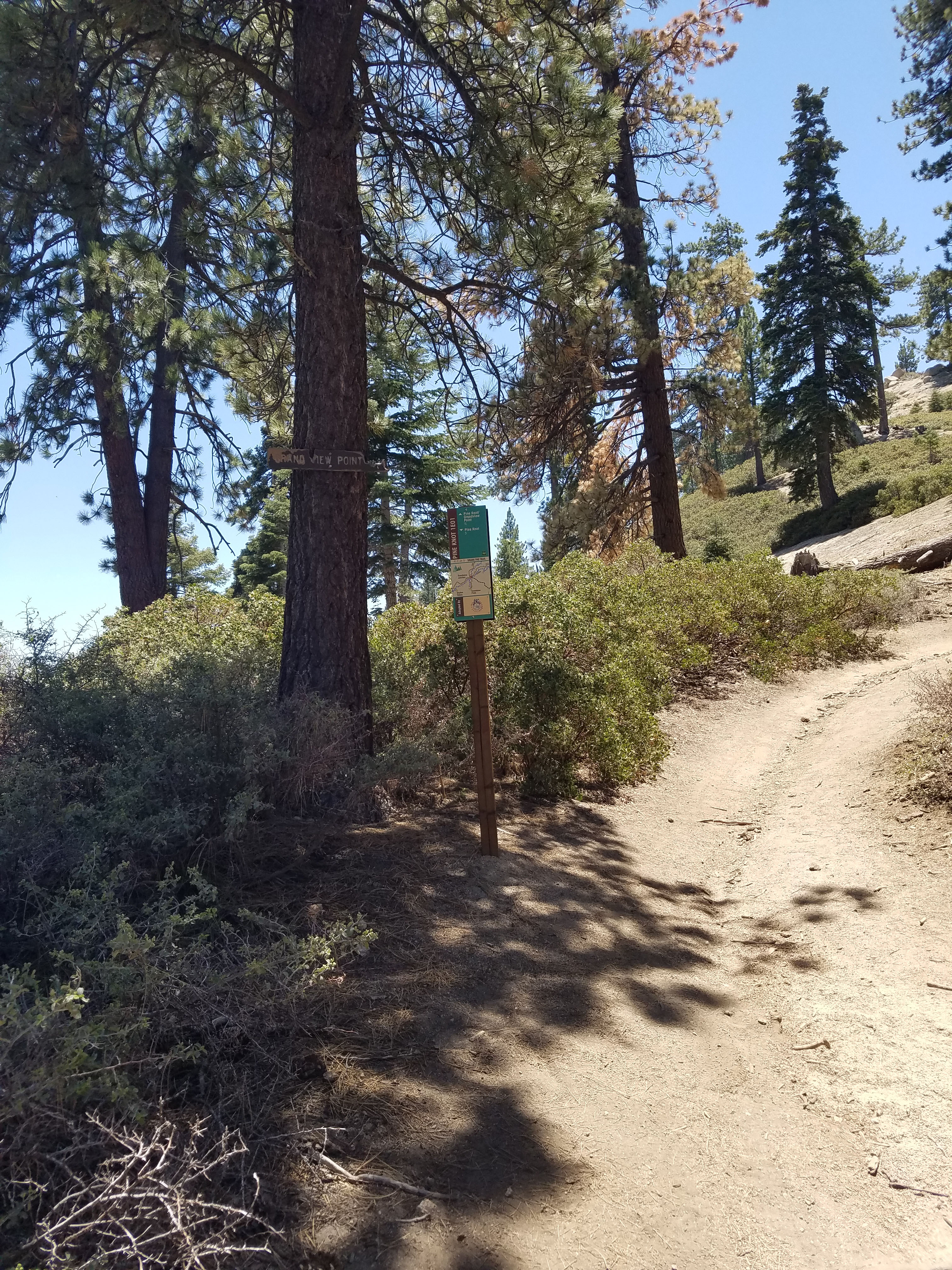
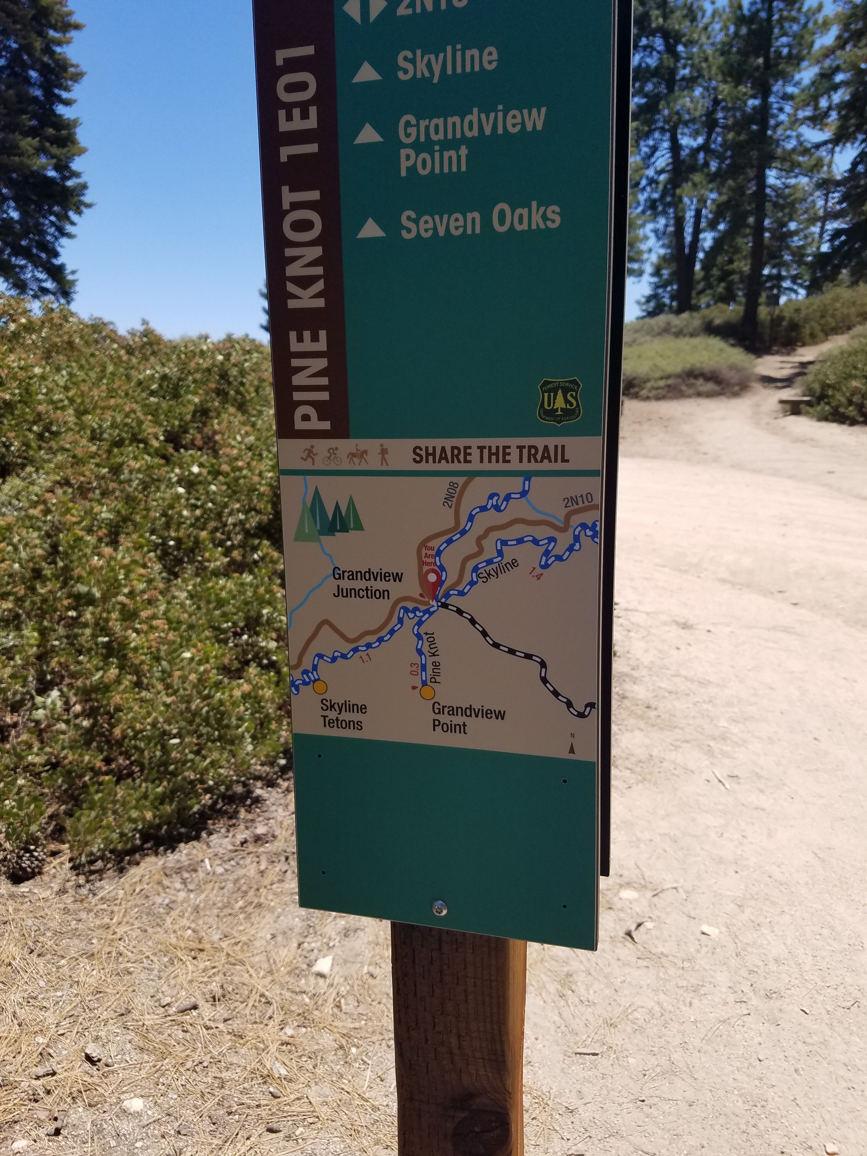
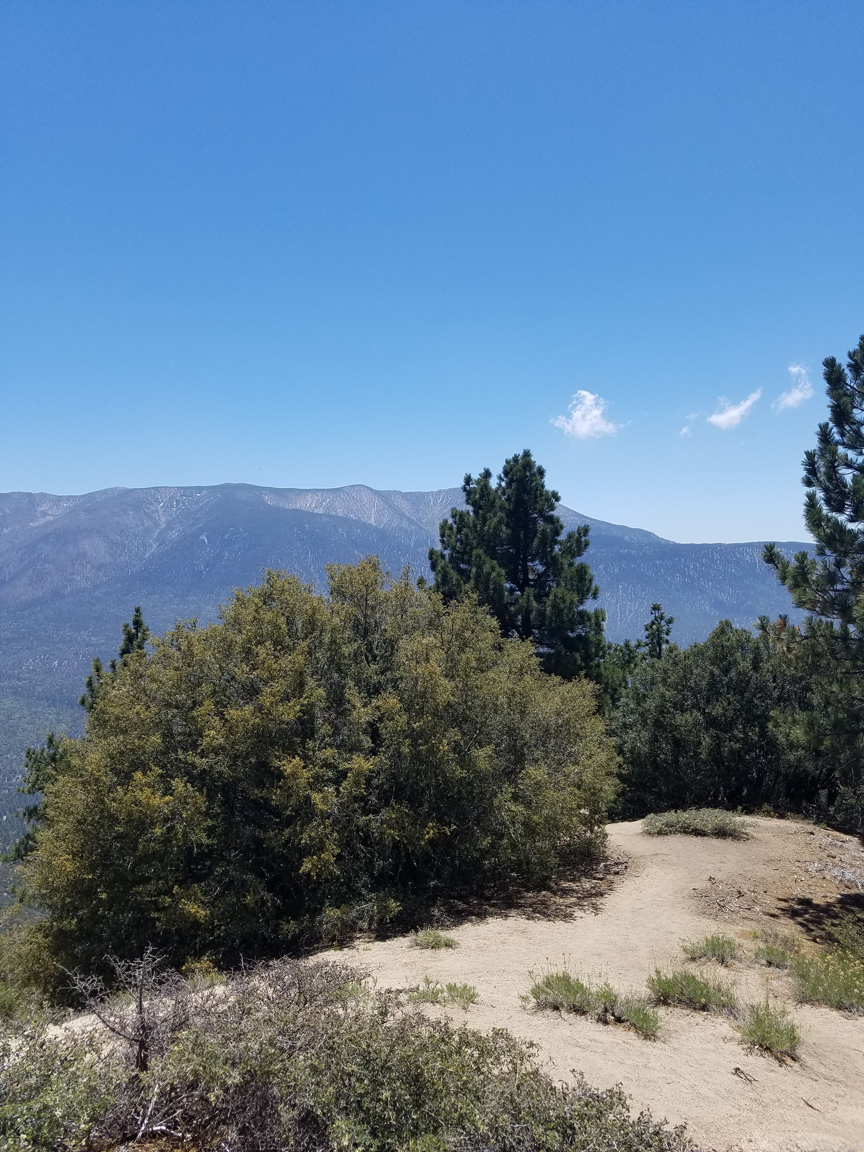
Beyond the campground, the trail starts to level out. Eventually you come to the Skyline Ridge road and trail. At this point you simply follow the signs straight ahead to a short climb to Grand View Point. The trail ends at Grand View Point which has some nice places to sit and enjoy the views.
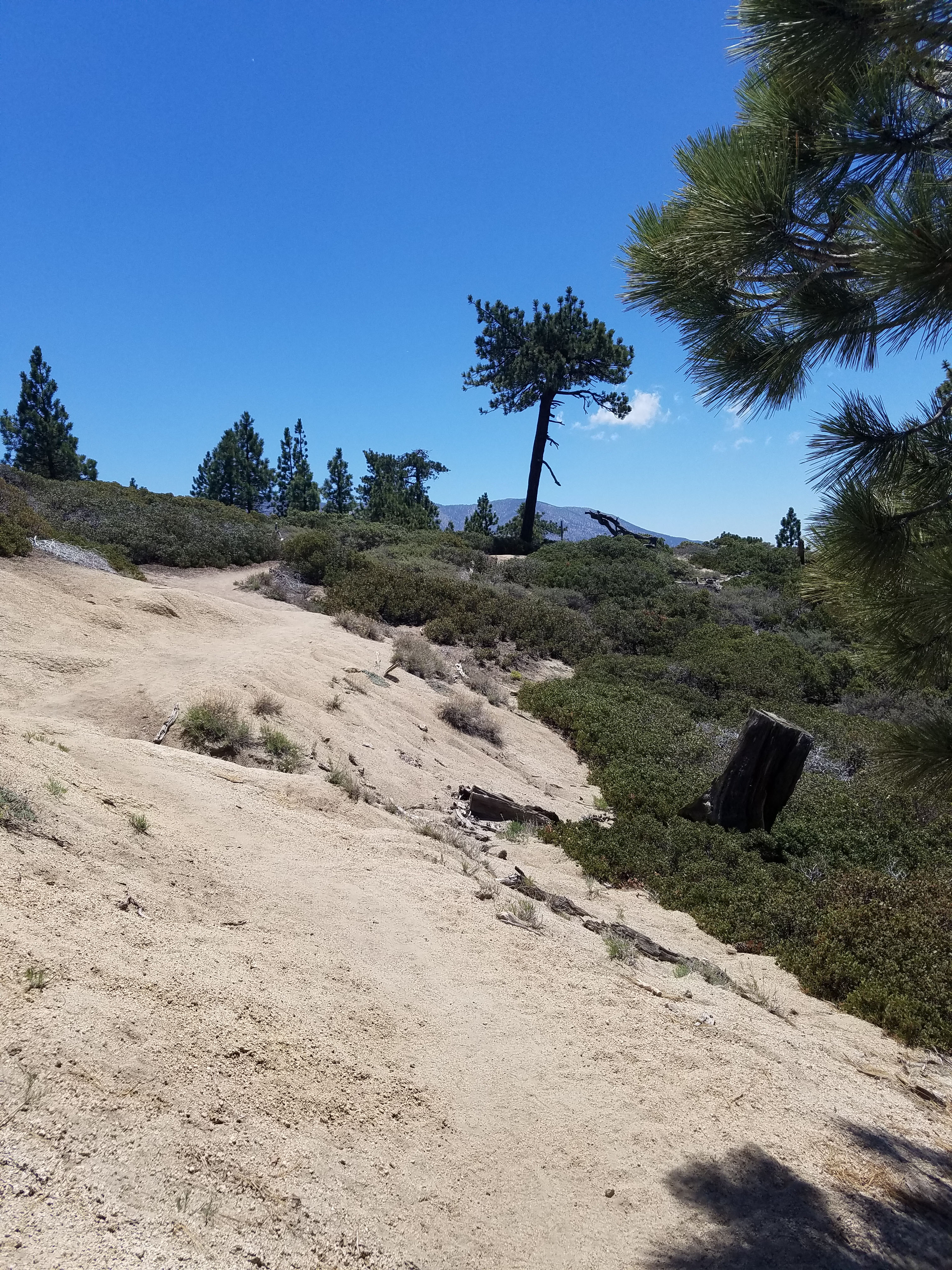
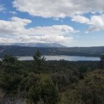
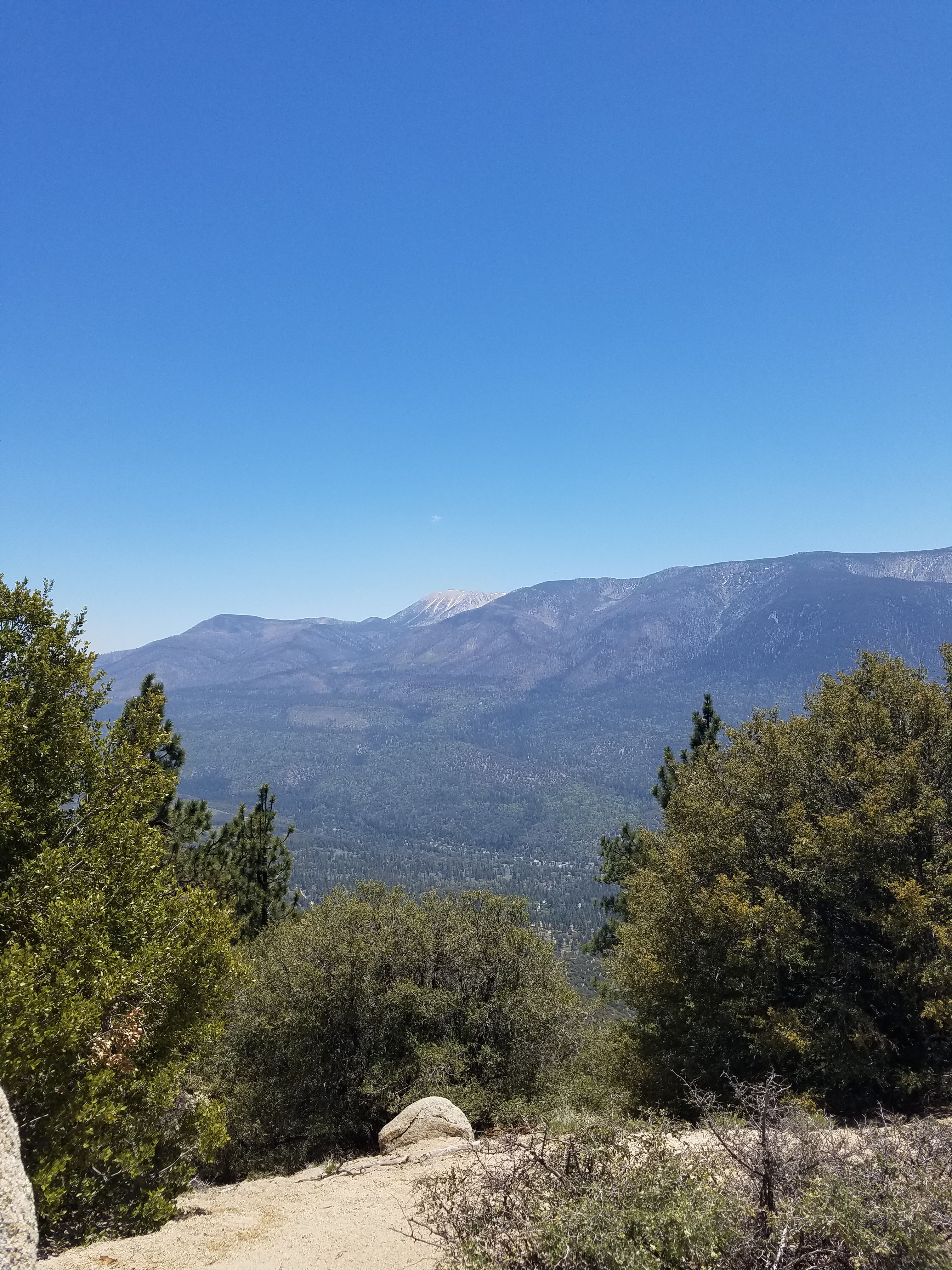
Along the climb up Pine Knot Trail you will get many great views of Big Bear Lake. However, Grand View Point focuses on looking to the 11,000 foot San Bernardino. At 11,500 feet San Gorgonio Mountain is the highest in Southern California. Because it rises from the sea level desert near Palm Springs, it has one of the highest vertical rises of any mountain in the United States.
There are many options for hiking beyond this point. If a 7-mile hike is enough for you simply head back the way you came. There are many trails and numbered roads which take you along the ridge and down the mountain. On the day I tracked this hike, I did a 12-mile loop, heading east along Skyline Road (2N10) to the top of the Snow Summit ski area where I headed down via 2N15 to 2N08 which becomes Knickerbocker Road as it enters downtown Big Bear Lake. From there it is a little under 2 miles along the road back to the Aspen Glen Picnic area.
This is also a big area for mountain biking, with trails for all levels. I saw some people biking up the trails, but most people take the Snow Summit chair lift.
Overall, this is a fairly moderate hike. However, it is the most difficult of our family-friendly Big Bear hikes. Some guides indicate that this hike is only 6-miles. Our GPS said it was 3.8 miles from the picnic area to Grand View Point and this has been confirmed by other sources.
For our guide to other hikes in the area go here.